Area Overview for Hoar Cross
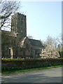
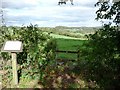
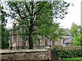
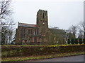
Photos of Hoar Cross
Area Information
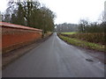
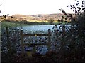
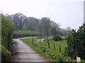
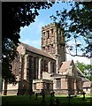
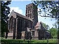
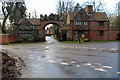
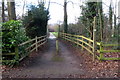
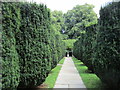
Hoar Cross is a small civil parish covering an area of 7.1 square kilometres. You will find a quiet, established community where daily life revolves around low-density living. The location sits comfortably outside the main high streets of Sutton Coldfield, offering a retreat from busy city traffic while remaining accessible. Residents appreciate the stability of the area, knowing that development is constrained by local planning protections. You are looking at a neighbourhood defined by its permanence rather than rapid change. The space allows for a slower pace of life, yet digital infrastructure supports modern remote working needs. Mobile signals reach most corners of the parish reliably. Fixed broadband covers the area adequately for standard streaming and browsing. While the footprint is small, the home ownership level reflects a long-term commitment to the locale. You are stepping into an environment where neighbours have been settled for decades. The lack of major planning constraints like AONB or protected wetlands means the landscape remains stable. Protected woodland does exist within the boundaries, adding green value to the surroundings. This mix of open space and residential stability creates a predictable environment for families and retirees alike.
- Area Type
- Parish
- Area Size
- 7.1 km²
- Population
- Not available
- Population Density
- Not available
Demographics
The community in Hoar Cross is defined by its mature population profile. The median age here reaches 70 years, indicating a demographic heavily skewed towards seniors. This age distribution shapes the daily rhythm of the neighbourhood, with quiet streets and a focus on leisure rather than nightlife. Home ownership stands at 84 per cent, which is exceptionally high for any modern UK market. You are far more likely to own your property outright than in national averages. Most households consist of adults living in single-family dwellings rather than shared accommodations. This high rate of ownership suggests residents view the area as a permanent home base. Diversity metrics are not detailed in the available records for this specific parish. The religious composition similarly lacks specific breakdown data in the current profile. While specific figures for household composition totals are not explicitly listed as a separate number beyond the general ownership stat, the ownership figure strongly implies standard family or couple-led households. Deprivation data is not included in the provided statistics, so you cannot estimate economic hardship levels for this specific parish. What remains clear is a community built on stability and ownership rather than transient renting.
Household Size
Accommodation Type
Tenure
Ethnic Group
Religion
Household Composition
Age
Household Deprivation
NS-SEC
Explore more demographic insights in this area
Go to Demographics tabPlanning
Planning Constraints
- Flood RiskPremium
- Ramsar Wetland SitesPremium
- Area of Outstanding Natural BeautyPremium
- Protected Nature ReservePremium
- Protected WoodlandPremium
- Crime RiskPremium