Area Overview for Herefordshire
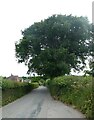
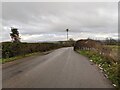
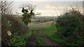
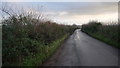
Photos of Herefordshire
Area Information
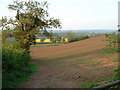
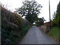
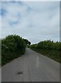
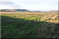
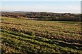
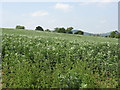
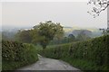
Living in Herefordshire means embracing a rural lifestyle within a ceremonial county and unitary authority situated in the westernmost part of the West Midlands region. You reside in an area covering 2,181.2 km², bordered by Shropshire, Worcestershire, Gloucestershire, and the Welsh counties of Monmouthshire and Powys. The county town is Hereford, the largest settlement located along the River Wye. This district is defined by rolling countryside, apple orchards, and a strong agricultural character governed by Herefordshire Council since 1998. You are surrounded by historic landmarks such as Hereford Cathedral with its Mappa Mundi and Romanesque Churches like St. Mary and St. David at Kilpeck. The landscape features sparse population and a traditional atmosphere reflective of its agrarian roots. You can walk past ruined 12th-century Norman fortresses at Wilton, Goodrich, and Pembridge while viewing early English Cistercian abbey churches at Abbey Dore. Daily life here is shaped by the presence of Hereford cattle and largely unspoilt terrain. This geographic spread from the Welsh borderland to central settlements offers a distinct experience away from urban density. You connect with a community that has existed since the reign of King Athelstan, with borders once defined by warfare against the Welsh until Harold Godwinson restored order in 1063. Your home could sit near a former Norman fortress like Ewyas Harold or Wigmore. The area combines deep history with a quiet, pastoral present.
- Area Type
- Ceremonial Counties Region
- Area Size
- 2181.2 km²
- Population
- Not available
- Population Density
- Not available
Demographics
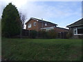
The community in Herefordshire has a distinct age profile with a median age of 70. This figure indicates a population skewed significantly towards older residents compared to national averages. The most common age range is listed as Age: Total, suggesting the data aggregates across all brackets without isolating younger cohorts. A very high proportion of the population owns their homes, with 68% of households being owner-occupied. This statistic underscores a long-standing connection between residents and the land they inhabit. Household composition and accommodation type figures are recorded as total, meaning specific breakdowns into singles, families, or shared houses are not available in the current dataset. Similarly, predominant ethnic group and religion categories are noted only as total. You live in an area where ownership is the norm rather than the exception. The demographic landscape reflects a mature community where stability and tenure are prevalent. You should expect neighbours who have likely lived in the area for decades. The age structure suggests schools may cater primarily to younger families moving in recently, as the median age points to a grey demographic dominating the resident count. Despite the lack of granular data on diversity or faith, the sheer level of home ownership shapes the social fabric.