Area Overview for Hednesford Hills & Rawnsley Ward
Photos of Hednesford Hills & Rawnsley Ward
Area Information
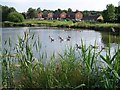
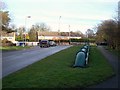
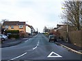
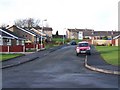
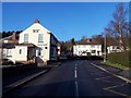
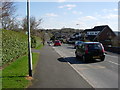
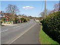
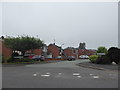
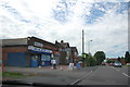
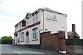
Living in Hednesford Hills & Rawnsley Ward offers a distinctive lifestyle centred on the southern gateway to Cannock Chase. This electoral ward sits within Cannock Chase District Council and spans an area of 8.1 km². It encompasses specific localities including Cannock Wood parish, Prospect Village, Hazelslade, and Rawnsley, alongside eastern parts of Hednesford parish. The location is strategically positioned approximately one mile north of Cannock and five miles south of Rugeley. Coordinates place the centre near 52.708373, -1.958925. The ward adjoins Hednesford Hills Nature Reserve to the east of the town centre and borders Anglesey Nature Reserve. It sits boundary-side with the wider Cannock Chase Area of Outstanding Natural Beauty to the north and west. Residents enjoy direct access to the Chase Line railway at Hednesford station, which has operated since its reopening in 1989. This transport hub provides West Midlands Railway services connecting passengers to Rugeley Trent Valley and Birmingham. The A460 road links the area to Wolverhampton and Rugeley, while bus services like the Chaserider 25 and Select 23 connect the interchange to Lichfield and other key destinations. Life here balances proximity to historic towns with the quiet setting of the coalfield and reserves.
- Area Type
- District Borough Unitary Ward
- Area Size
- 8.1 km²
- Population
- Not available
- Population Density
- Not available
Demographics
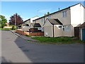
The community profile of Hednesford Hills & Rawnsley Ward is strongly defined by an older demographic. The median age for residents is 70 years, making it one of the oldest populations in the region. This age structure suggests a neighbourhood where retirement living and established families dominate the street scenes. Home ownership stands at a high rate of 75%, indicating that the majority of households own their dwellings outright or with significant equity. This statistic underpins a stable residential environment rather than a volatile rental market. The area serves as a quiet refuge for those seeking independence in their later years. While specific data on household composition by family type and predominant ethnic groups are not detailed in the current statistics, the high ownership rate and advanced median age provide a clear picture of the resident base. There is no indication of significant youth migration into the ward, reinforcing its character as a mature district. For anyone looking to understand the social fabric of living in this ward, the data points clearly toward a senior-centric community where residents value stability over rapid change.
Household Size
Accommodation Type
Tenure
Ethnic Group
Religion
Household Composition
Age
Household Deprivation
NS-SEC
Explore more demographic insights in this area
Go to Demographics tabPlanning
Planning Constraints
- Flood RiskLocked
- Ramsar Wetland SitesLocked
- Area of Outstanding Natural BeautyLocked
- Protected Nature ReserveLocked
- Protected WoodlandLocked
- Crime RiskLocked