Area Overview for Hawks Green with Rumer Hill Ward
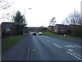
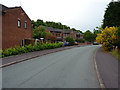
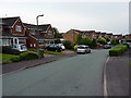
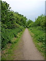
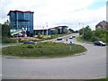
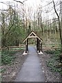
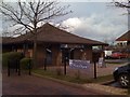
Photos of Hawks Green with Rumer Hill Ward
Area Information
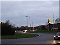
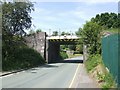
Living in Hawks Green with Rumer Hill Ward offers residents a compact yet strategically positioned lifestyle within Cannock Chase district. This electoral ward covers an area of 2.6 km², serving as a key location for local planning and council representation in the West Midlands. The location sits at approximately 52.6915°N, -2.0080°W, integrating closely with neighbouring subdivisions such as Heath Hayes and Wimblebury. Your daily life is defined by proximity to major transport arteries including the M6, M6 Toll, and M54 motorways, alongside the A5 and A34 roads. Cannock railway station operates on the Chase Line, providing a direct 36-minute journey to Birmingham and connections to London Euston. For those requiring bus transport, services from Cannock Bus Station reach destinations like Stafford, Wolverhampton, and Lichfield. The area functions as a functional residential hub that balances local connectivity with access to wider regional networks. Prospective buyers will find that Hawks Green with Rumer Hill Ward provides a straightforward base for commuting while maintaining distinct local identity. ### The community profile of Hawks Green with Rumer Hill Ward reflects a mature demographic landscape. Data indicates that the median age within the ward is 70, marking it as a district heavily populated by older residents. You will find that the most common age range corresponds to the total population distribution, confirming a consistent elderly demographic throughout the 2.6 km² area. Home ownership stands at a prevalent 68% of households, suggesting a stable resident base with long-term ties to the locality. This high rate of ownership typically correlates with residents who have established roots rather than transient tenants. The household composition and accommodation types reflect this settled nature, though specific breakdowns of those metrics are aggregated in the total figures. While the ward does not provide explicit statistics on predominant ethnic groups or religious affiliations, the overall picture points toward an established community structure. A safety score of 72 out of 100 further indicates a below-average crime rate, reinforcing the perception of a secure environment for this older population. These factors combine to create a neighbourhood where stability and quietude are paramount. ### The property market in Hawks Green with Rumer Hill Ward is characterised by a significant lean toward owner-occupancy. With 68% of households owning their homes, the area functions primarily as a residential stock for settled buyers rather than the rental sector. This high ownership rate implies that the housing infrastructure is built around families and individuals who have purchased properties to live in long term. Your search for homes in Hawks Green with Rumer Hill Ward will likely encounter a variety of tenure types, yet the dominance of ownership suggests limited rental availability within the ward boundaries. The ward code E05015747 identifies this specific district borough unitary ward where these transactions occur. Although specific data on accommodation types is aggregated under total figures, the overwhelming percentage of ownership points toward traditional family homes or single-unit dwellings suitable for retirees. Buyers looking at this area can expect a market where purchase figures outweigh rental listings. The nature of the stock aligns with the demographic profile, catering to those seeking stability rather than temporary accommodation. Understanding this owner-led dynamic is essential for anyone evaluating the feasibility of buying or investing in this specific ward. ### Connectivity for residents of Hawks Green with Rumer Hill Ward is excellent, supported by superior digital infrastructure and robust physical transport links. Your fixed broadband quality score reaches 98 out of 100, placing this area among the top tier for internet performance across the region. Such a rating ensures that working from home or streaming high-definition content faces no technical limitations. Commuter residents benefit from close proximity to the M6, M6 Toll, and M54 motorways, facilitating easy access to national job markets. The A5 and A34 A-roads provide additional east-west and north-south routes through Cannock. Railway travel is managed via Cannon Chase Line services that stop at Cannock station, offering a 36-minute journey to Birmingham and extended links to London Euston. Bus services connect the ward to towns including Hednesford, Stafford, and Wolverhampton. This combination of road, rail, and fibre optics means you can manage your daily logistics with minimal friction. Digital connectivity supports modern work life, while the road network supports flexible travel times. ### Safety and environmental assessments for Hawks Green with Rumer Hill Ward reveal a neighbourhood with minimal constraints and low risk factors. The crime risk assessment yields a score of 72 out of 100, classifying the area as having a low crime risk. This metric indicates below-average crime rates compared to other parts of the country, making Hawks Green with Rumer Hill Ward a secure choice for residents and families alike. Environmental safety also presents positively, with a flood risk coverage score of 2.4, which signifies a low flood risk. Planning constraints are equally clear, as the ward passes all key environmental checks. There is no Ramsar wetland site coverage, no Area of Outstanding Natural Beauty designation, and no protected nature reserve or protected woodland within the boundaries. These clear passes mean that planning decisions face fewer restrictions than in conservation-rich zones. You can expect a straightforward planning environment without the complexities often found in areas designated for special environmental protection. The combination of low crime statistics and unrestricted planning status makes the area an accessible and safe option for prospective homebuyers. ### What is the safety record like for Hawks Green with Rumer Hill Ward?The ward has a safety score of 72 out of 100, indicating low crime risk with below-average crime rates. Residents benefit from an environment where safety is not a primary concern. Who typically lives in Hawks Green with Rumer Hill Ward?The median age is 70, meaning the population is predominantly older adults. Home ownership is high at 68%, reflecting a community of settled residents rather than transient tenants. How well connected is the area to major cities?Cannock railway station offers a 36-minute service to Birmingham and links to London Euston. The area is also served by the M6, M6 Toll, and M54 motorways for road travel. Are there environmental risks I should worry about?There are no significant environmental constraints. Flood risk is low at a score of 2.4, and there are no protected wetlands, nature reserves, or Areas of Outstanding Natural Beauty in the ward.
- Area Type
- District Borough Unitary Ward
- Area Size
- 2.6 km²
- Population
- Not available
- Population Density
- Not available
Demographics
The community profile of Hawks Green with Rumer Hill Ward reflects a mature demographic landscape. Data indicates that the median age within the ward is 70, marking it as a district heavily populated by older residents. You will find that the most common age range corresponds to the total population distribution, confirming a consistent elderly demographic throughout the 2.6 km² area. Home ownership stands at a prevalent 68% of households, suggesting a stable resident base with long-term ties to the locality. This high rate of ownership typically correlates with residents who have established roots rather than transient tenants. The household composition and accommodation types reflect this settled nature, though specific breakdowns of those metrics are aggregated in the total figures. While the ward does not provide explicit statistics on predominant ethnic groups or religious affiliations, the overall picture points toward an established community structure. A safety score of 72 out of 100 further indicates a below-average crime rate, reinforcing the perception of a secure environment for this older population. These factors combine to create a neighbourhood where stability and quietude are paramount. ### The property market in Hawks Green with Rumer Hill Ward is characterised by a significant lean toward owner-occupancy. With 68% of households owning their homes, the area functions primarily as a residential stock for settled buyers rather than the rental sector. This high ownership rate implies that the housing infrastructure is built around families and individuals who have purchased properties to live in long term. Your search for homes in Hawks Green with Rumer Hill Ward will likely encounter a variety of tenure types, yet the dominance of ownership suggests limited rental availability within the ward boundaries. The ward code E05015747 identifies this specific district borough unitary ward where these transactions occur. Although specific data on accommodation types is aggregated under total figures, the overwhelming percentage of ownership points toward traditional family homes or single-unit dwellings suitable for retirees. Buyers looking at this area can expect a market where purchase figures outweigh rental listings. The nature of the stock aligns with the demographic profile, catering to those seeking stability rather than temporary accommodation. Understanding this owner-led dynamic is essential for anyone evaluating the feasibility of buying or investing in this specific ward. ### Connectivity for residents of Hawks Green with Rumer Hill Ward is excellent, supported by superior digital infrastructure and robust physical transport links. Your fixed broadband quality score reaches 98 out of 100, placing this area among the top tier for internet performance across the region. Such a rating ensures that working from home or streaming high-definition content faces no technical limitations. Commuter residents benefit from close proximity to the M6, M6 Toll, and M54 motorways, facilitating easy access to national job markets. The A5 and A34 A-roads provide additional east-west and north-south routes through Cannock. Railway travel is managed via Cannon Chase Line services that stop at Cannock station, offering a 36-minute journey to Birmingham and extended links to London Euston. Bus services connect the ward to towns including Hednesford, Stafford, and Wolverhampton. This combination of road, rail, and fibre optics means you can manage your daily logistics with minimal friction. Digital connectivity supports modern work life, while the road network supports flexible travel times. ### Safety and environmental assessments for Hawks Green with Rumer Hill Ward reveal a neighbourhood with minimal constraints and low risk factors. The crime risk assessment yields a score of 72 out of 100, classifying the area as having a low crime risk. This metric indicates below-average crime rates compared to other parts of the country, making Hawks Green with Rumer Hill Ward a secure choice for residents and families alike. Environmental safety also presents positively, with a flood risk coverage score of 2.4, which signifies a low flood risk. Planning constraints are equally clear, as the ward passes all key environmental checks. There is no Ramsar wetland site coverage, no Area of Outstanding Natural Beauty designation, and no protected nature reserve or protected woodland within the boundaries. These clear passes mean that planning decisions face fewer restrictions than in conservation-rich zones. You can expect a straightforward planning environment without the complexities often found in areas designated for special environmental protection. The combination of low crime statistics and unrestricted planning status makes the area an accessible and safe option for prospective homebuyers. ### What is the safety record like for Hawks Green with Rumer Hill Ward?The ward has a safety score of 72 out of 100, indicating low crime risk with below-average crime rates. Residents benefit from an environment where safety is not a primary concern. Who typically lives in Hawks Green with Rumer Hill Ward?The median age is 70, meaning the population is predominantly older adults. Home ownership is high at 68%, reflecting a community of settled residents rather than transient tenants. How well connected is the area to major cities?Cannock railway station offers a 36-minute service to Birmingham and links to London Euston. The area is also served by the M6, M6 Toll, and M54 motorways for road travel. Are there environmental risks I should worry about?There are no significant environmental constraints. Flood risk is low at a score of 2.4, and there are no protected wetlands, nature reserves, or Areas of Outstanding Natural Beauty in the ward.
Household Size
Accommodation Type
Tenure
Ethnic Group
Religion
Household Composition
Age
Household Deprivation
NS-SEC
Explore more demographic insights in this area
Go to Demographics tabPlanning
Planning Constraints
- Flood RiskPremium
- Ramsar Wetland SitesPremium
- Area of Outstanding Natural BeautyPremium
- Protected Nature ReservePremium
- Protected WoodlandPremium
- Crime RiskPremium