Area Overview for Hatton
Photos of Hatton
Area Information
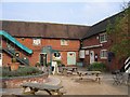
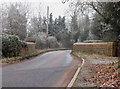
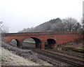
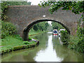
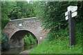
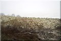
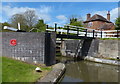
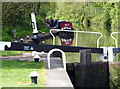
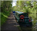
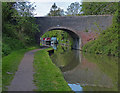
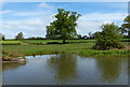
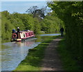
Living in Hatton offers a distinct rural experience within the Warwick District of Warwickshire, blending village charm with accessible infrastructure. This civil parish spans 5.6 km², while the parish itself recorded a population of 2,319 at the 2011 Census, with figures suggesting a community close to 2,612 residents today. The area lies approximately 3.5 miles from Warwick, situated near the Birmingham and Warwick Canal and the Oxford to Birmingham railway line. Residents enjoy proximity to the hamlets of Beausall and Shrewley, creating a subdivided property environment characterised by farmland and historic landmarks. The village features the Holy Trinity Church, rebuilt in 1880 but retaining a 13th-century tower, alongside Hatton Locks. This flight of 21 locks on the Grand Union Canal spans less than 2 miles with a total rise of 45 metres, offering a prominent local feature. Historically significant, the site once housed a county lunatic asylum built in the mid-19th century, which now operates as a hospital. The local economy historically centred on agriculture covering 4,099 acres, a legacy that influences the current landscape. Today, the combination of canal-side location, transport links including the nearby M40 motorway, and access to the market town of Warwick defines daily life. You can find homes here that reflect a mix of historic character and suburban convenience, avoiding the constraints often found in protected sites.
- Area Type
- Parish
- Area Size
- 5.6 km²
- Population
- Not available
- Population Density
- Not available
Demographics
The community in Hatton is defined by a notably older population profile compared to many urban centres. The median age here is 70, indicating a resident base dominated by retirees and long-term inhabitants rather than young families or students. Historical household data and age range summaries point to a stable, established neighbourhood where the typical resident has lived for decades. The area records a home ownership rate of 78%, confirming that the vast majority of properties are owned outright or via mortgage by the people living in them. This high level of tenure stability suggests a community invested in local schools and amenities rather than transient rental living. While specific details on ethnic diversity, household composition, and religious affiliation are recorded in the parish's total census files, the overriding demographic fact is the age structure. With a median age of 70, services and social groups in Hatton likely cater to mature adults. This demographic reality means the local atmosphere is generally quiet and settled, reflective of a retirement destination or a place for those seeking a slower pace of life away from city centres. The high ownership percentage further reinforces the idea that this is a place people choose to settle down permanently. For you, this translates to a predictable environment where the same neighbours have likely graced the village green for generations.
Household Size
Accommodation Type
Tenure
Ethnic Group
Religion
Household Composition
Age
Household Deprivation
NS-SEC
Explore more demographic insights in this area
Go to Demographics tabPlanning
Planning Constraints
- Flood RiskPremium
- Ramsar Wetland SitesPremium
- Area of Outstanding Natural BeautyPremium
- Protected Nature ReservePremium
- Protected WoodlandPremium
- Crime RiskPremium