Area Overview for Halesowen North Ward
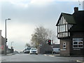
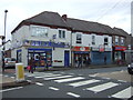
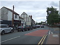
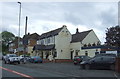
Photos of Halesowen North Ward
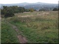
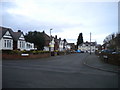
![Remains of Stewarts & Lloyds Coombeswood Works [2] in Halesowen North Ward](https://images.propbar.co.uk/images/geograph/58/08/5808887_120.jpg)
Area Information
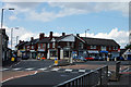
Halesowen North Ward presents a quiet residential option within the Metropolitan Borough of Dudley, situated in the West Midlands county of England. This district borough unitary ward covers a compact area of 4.1 square kilometres and supports a total population of 3,264 residents. The community sits approximately six miles west of Birmingham, positioned strategically close to the wider city while maintaining a distinct local character. Historical context adds depth to its current identity, as the area was once a significant hub during the Industrial Revolution, known for its role in coal mining and nail manufacturing. Today, the ward retains a link to its past through landmarks such as the Parish Church of St John the Baptist, which stands on the site of an earlier Anglo-Saxon church founded by Roger de Montgomery. Nearby ruins of Halesowen Abbey serve as a reminder of the town's medieval heritage, where the abbesty controlled a vast estate for over three centuries. Living in Halesowen North Ward offers proximity to these historical features and access to local amenities found in the market town of Halesowen. The ward's coordinates place it firmly within the region's established infrastructure, making it a practical choice for those seeking a home with historical roots and modern accessibility. The combination of a defined urban layout and significant historical presence makes this ward a notable part of the local landscape.
- Area Type
- District Borough Unitary Ward
- Area Size
- 4.1 km²
- Population
- 3264
- Population Density
- 803 people/km²
Demographics
The demographic profile of Halesowen North Ward reveals a community with an older profile. The median age across the ward stands at 70 years, indicating a population skewed significantly towards retirement age compared to the national average. This age distribution suggests a neighbourhood where residents typically value stability and quiet over high-energy urban development. Nearly three-quarters of households, amounting to 72 per cent, are owner-occupied. This high level of home ownership points to a community where families have settled permanently rather than renting transiently. The ward functions primarily as a retirement bloc or a location for older couples seeking independence. Data regarding the most common age range confirms that the "Total" population metrics drive these figures, overriding any specific youth demographic. You will find a homogeneous community where long-term residents dominate property ownership. The low population density relative to the size of the ward, coupled with an aging demographic, means you should anticipate a slower pace of life. There are few indicators of a young professional influx or a large student population in this specific ward. The social fabric is likely built around neighbours who have lived in the same properties for decades, creating a tight-knit but potentially quiet community dynamic suitable for those in retirement.
Household Size
Accommodation Type
Tenure
Ethnic Group
Religion
Household Composition
Age
Household Deprivation
NS-SEC
Explore more demographic insights in this area
Go to Demographics tabPlanning
Planning Constraints
- Flood RiskPremium
- Ramsar Wetland SitesPremium
- Area of Outstanding Natural BeautyPremium
- Protected Nature ReservePremium
- Protected WoodlandPremium
- Crime RiskPremium