Area Overview for GL56 9SA
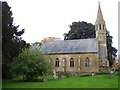
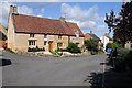
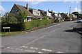
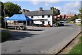
Photos of GL56 9SA
![Path to Stretton-on-Fosse [5] in GL56 9SA](https://images.propbar.co.uk/images/geograph/19/23/1923144_120.jpg)
![Path to Stretton-on-Fosse [6] in GL56 9SA](https://images.propbar.co.uk/images/geograph/19/23/1923154_120.jpg)
![Path to Stretton-on-Fosse [7] in GL56 9SA](https://images.propbar.co.uk/images/geograph/19/23/1923159_120.jpg)
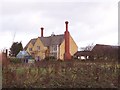
![Path to Stretton-on-Fosse [8] in GL56 9SA](https://images.propbar.co.uk/images/geograph/19/23/1923162_120.jpg)
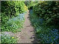
![Village path [1] in GL56 9SA](https://images.propbar.co.uk/images/geograph/19/23/1923164_120.jpg)
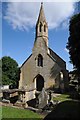
33 photos from this area
Area Information
Key information about the GL56 9SA including its size, population, and administrative classification.
- Area Type
- Postcode
- Area Size
- 4.1 hectares
- Population
- 2120
- Population Density
- 33 people/km²
House Prices in GL56 9SA
19
Properties
£409,429
Average Sold Price
£182,500
Lowest Price
£635,000
Highest Price
Showing 19 properties
| Address | Type | Beds | Baths | Last Sale Price | Last Sale Date | |
|---|---|---|---|---|---|---|
| Sunrise Cottage, Main Street, Stretton On Fosse, GL56 9SA | Semi-detached | 2 | 1 | £635,000 | Jan 2018 | |
| The Old Post Office, Main Street, Stretton On Fosse, GL56 9SA | Cottage | 3 | 1 | £360,000 | Apr 2017 | |
| Gaydon Cottage, Main Street, Stretton On Fosse, GL56 9SA | Detached | 3 | 1 | £397,500 | Oct 2016 | |
| The Barn, Main Street, Stretton On Fosse, GL56 9SA | Detached | - | - | £455,000 | Feb 2013 | |
| Home Farm, Main Street, Stretton On Fosse, GL56 9SA | Detached | - | - | £511,000 | May 2009 | |
| Rickyard Cottage, Main Street, Stretton On Fosse, GL56 9SA | Detached | 2 | 1 | £325,000 | Aug 2007 | |
| Sunnybank, Main Street, Stretton On Fosse, GL56 9SA | Semi-detached | 3 | 1 | £182,500 | Aug 2005 | |
| Farlow, Main Street, Stretton On Fosse, GL56 9SA | Bungalow | 2 | 1 | - | - | |
| Rozel, Main Street, Stretton On Fosse, GL56 9SA | Bungalow | 2 | 1 | - | - | |
| Casmia, Main Street, Stretton On Fosse, GL56 9SA | Cottage | 2 | 1 | - | - |
Page 1 of 2
Energy Efficiency in GL56 9SA
Amenities
Schools
| Rank | School | Type | Entry gender | Ages |
|---|
Explore more schools in this area
Go to Schools tabDemographics
Household Size
Two person
most common
Accommodation Type
Houses
most common
Tenure
76
majority
Ethnic Group
White
most common
Religion
N/A
most common
Household Composition
N/A
most common
Age
47
median
Adults (30-64 years)
most common
Household Deprivation
N/A
with no deprivation
NS-SEC
43
in Lower managerial occupations
Explore more demographic insights in this area
Go to Demographics tabPlanning
Planning Constraints
- Flood RiskPremium
- Ramsar Wetland SitesPremium
- Area of Outstanding Natural BeautyPremium
- Protected Nature ReservePremium
- Protected WoodlandPremium