Area Overview for GL56 0PG
Photos of GL56 0PG
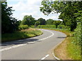
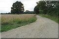
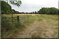
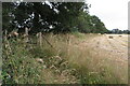
28 photos from this area
Area Information
Key information about the GL56 0PG including its size, population, and administrative classification.
- Area Type
- Postcode
- Area Size
- 1.5 km²
- Population
- 2220
- Population Density
- 41 people/km²
House Prices in GL56 0PG
9
Properties
£862,488
Average Sold Price
£599,950
Lowest Price
£1,450,000
Highest Price
Showing 9 properties
| Address | Type | Beds | Baths | Last Sale Price | Last Sale Date | |
|---|---|---|---|---|---|---|
| Heath House, London Road, Little Compton, GL56 0PG | house | - | - | £1,450,000 | Jun 2024 | |
| Shire House, London Road, Moreton In Marsh, GL56 0PG | Detached | 4 | 2 | £700,000 | Oct 2020 | |
| Acorn Cottage, London Road, Kitebrook, Little Compton, GL56 0PG | Semi-detached | 7 | 6 | £700,000 | Jul 2018 | |
| Woodlands, London Road, Little Compton, GL56 0PG | Semi-detached | 4 | - | £599,950 | Apr 2015 | |
| Heath Farm, London Road, Little Compton, GL56 0PG | Detached | 6 | 7 | - | - | |
| Briars, London Road, Little Compton, GL56 0PG | Retail | 4 | 2 | - | - | |
| Bungalow Farm Site, London Road, Kitebrook, Little Compton, GL56 0PG | Mobile Home | - | - | - | - | |
| Greenacres, London Road, Little Compton, GL56 0PG | Semi-detached | - | - | - | - | |
| Heathfield House, London Road, Moreton In Marsh, GL56 0PG | Detached | - | - | - | - |
Energy Efficiency in GL56 0PG
Amenities
Schools
| Rank | School | Type | Entry gender | Ages |
|---|
Explore more schools in this area
Go to Schools tabDemographics
Household Size
Two person
most common
Accommodation Type
Houses
most common
Tenure
74
majority
Ethnic Group
White
most common
Religion
N/A
most common
Household Composition
N/A
most common
Age
47
median
Adults (30-64 years)
most common
Household Deprivation
N/A
with no deprivation
NS-SEC
44
in Lower managerial occupations
Explore more demographic insights in this area
Go to Demographics tabPlanning
Planning Constraints
- Flood RiskPremium
- Ramsar Wetland SitesPremium
- Area of Outstanding Natural BeautyPremium
- Protected Nature ReservePremium
- Protected WoodlandPremium