Area Overview for GL20 7JH
Photos of GL20 7JH
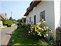
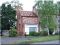
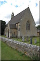
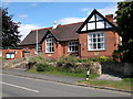
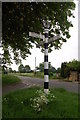
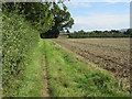
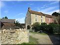
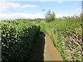
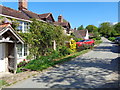
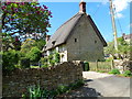
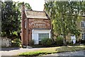
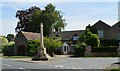
69 photos from this area
Area Information
Key information about the GL20 7JH including its size, population, and administrative classification.
- Area Type
- Postcode
- Area Size
- 9.6 hectares
- Population
- 1244
- Population Density
- 66 people/km²
House Prices in GL20 7JH
25
Properties
£192,922
Average Sold Price
£70,000
Lowest Price
£380,000
Highest Price
Showing 25 properties
| Address | Type | Beds | Baths | Last Sale Price | Last Sale Date | |
|---|---|---|---|---|---|---|
| 12 Bayliss Road, Kemerton, GL20 7JH | Semi-detached | 2 | 1 | £230,000 | Aug 2020 | |
| 7 Bayliss Road, Kemerton, GL20 7JH | Semi-detached | 4 | 2 | £380,000 | Feb 2020 | |
| 15 Bayliss Road, Kemerton, GL20 7JH | Semi-detached | 2 | 1 | £194,250 | Oct 2011 | |
| 4 Bayliss Road, Kemerton, GL20 7JH | Semi-detached | - | - | £265,000 | Aug 2006 | |
| 14 Bayliss Road, Kemerton, GL20 7JH | Semi-detached | 2 | - | £185,500 | Jul 2005 | |
| 10 Bayliss Road, Kemerton, GL20 7JH | Semi-detached | - | - | £155,551 | Dec 2003 | |
| 5 Bayliss Road, Kemerton, GL20 7JH | Semi-detached | - | - | £121,000 | May 2001 | |
| 9 Bayliss Road, Kemerton, GL20 7JH | Semi-detached | - | - | £135,000 | Nov 2000 | |
| 6 Bayliss Road, Kemerton, GL20 7JH | Semi-detached | - | - | £70,000 | Mar 1998 | |
| 2 Bayliss Road, Kemerton, GL20 7JH | Detached | 3 | 1 | - | - |
Page 1 of 3
Energy Efficiency in GL20 7JH
Amenities
Schools
| Rank | School | Type | Entry gender | Ages |
|---|
Explore more schools in this area
Go to Schools tabDemographics
Household Size
Two person
most common
Accommodation Type
Houses
most common
Tenure
60
majority
Ethnic Group
White
most common
Religion
N/A
most common
Household Composition
N/A
most common
Age
47
median
Adults (30-64 years)
most common
Household Deprivation
N/A
with no deprivation
NS-SEC
42
in Lower managerial occupations
Explore more demographic insights in this area
Go to Demographics tabPlanning
Planning Constraints
- Flood RiskPremium
- Ramsar Wetland SitesPremium
- Area of Outstanding Natural BeautyPremium
- Protected Nature ReservePremium
- Protected WoodlandPremium