Area Overview for GL20 7EZ
Photos of GL20 7EZ
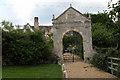

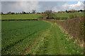
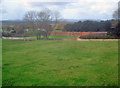


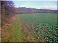
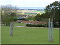
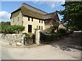
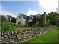
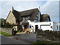
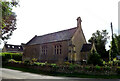
30 photos from this area
Area Information
Key information about the GL20 7EZ including its size, population, and administrative classification.
- Area Type
- Postcode
- Area Size
- 1.8 km²
- Population
- 1349
- Population Density
- 181 people/km²
House Prices in GL20 7EZ
48
Properties
£422,388
Average Sold Price
£175,000
Lowest Price
£1,050,000
Highest Price
Showing 48 properties
| Address | Type | Beds | Baths | Last Sale Price | Last Sale Date | |
|---|---|---|---|---|---|---|
| Manor Cottage, Manor Lane, Bredons Norton, GL20 7EZ | Cottage | 2 | 2 | £373,000 | Mar 2023 | |
| Bredons Norton Manor, Manor Lane, Bredons Norton, GL20 7EZ | Detached | 8 | 7 | £1,050,000 | Aug 2021 | |
| Homestead, Eckington Road, Bredons Norton, GL20 7EZ | house | - | - | £700,000 | Apr 2021 | |
| Roville, Manor Lane, Bredons Norton, GL20 7EZ | Detached | 4 | 2 | £510,000 | Jun 2018 | |
| Southcroft Cottage, Manor Lane, Bredons Norton, GL20 7EZ | Detached | 3 | 1 | £425,000 | Jun 2018 | |
| Malvern View, Rectory Farm Lane, Bredons Norton, GL20 7EZ | Semi-detached | - | - | £295,000 | Jan 2018 | |
| Manor Barn, Manor Lane, Bredons Norton, GL20 7EZ | Semi-detached | 5 | - | £562,000 | Dec 2016 | |
| Blue Jays, Manor Lane, Bredons Norton, GL20 7EZ | Semi-detached | 3 | - | £350,000 | Oct 2014 | |
| The Olde Forge, Rectory Farm Lane, Bredons Norton, GL20 7EZ | Detached | 4 | - | £370,000 | Oct 2013 | |
| Little Paddock, Manor Lane, Bredons Norton, GL20 7EZ | Semi-detached | - | - | £295,000 | Feb 2013 |
Page 1 of 5
Energy Efficiency in GL20 7EZ
Amenities
Schools
| Rank | School | Type | Entry gender | Ages |
|---|
Explore more schools in this area
Go to Schools tabDemographics
Household Size
Two person
most common
Accommodation Type
Houses
most common
Tenure
88
majority
Ethnic Group
White
most common
Religion
N/A
most common
Household Composition
N/A
most common
Age
47
median
Adults (30-64 years)
most common
Household Deprivation
N/A
with no deprivation
NS-SEC
50
in Lower managerial occupations
Explore more demographic insights in this area
Go to Demographics tabPlanning
Planning Constraints
- Flood RiskPremium
- Ramsar Wetland SitesPremium
- Area of Outstanding Natural BeautyPremium
- Protected Nature ReservePremium
- Protected WoodlandPremium