Area Overview for Friar Park Ward
Photos of Friar Park Ward

Area Information
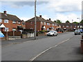
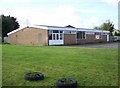
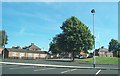
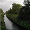
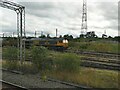
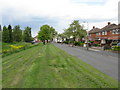
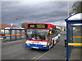
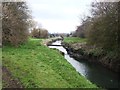
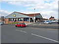
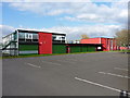
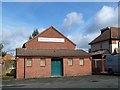
Friar Park Ward occupies 3.0 km² of residential land within the Sandwell metropolitan borough, home to 2,947 residents as of the latest census data. This suburb sits approximately one mile east of Wednesbury town centre and two miles north of West Bromwich, positioning it strategically between two established urban hubs. Originally developed in the late 1920s and early 1930s to rehouse families displaced by central slum clearances, the area retains its character as a council-led estate while accommodating modern housing developments. Since the 1960s, the ward has remained closely connected to the M6 motorway, facilitating quick access to regional job markets. The neighbourhood stands near The Woods suburb and Hall Green, creating a residential corridor through central Sandwell. Property types range from traditional council housing built during the estate's expansion phases to contemporary residential constructions developed in more recent years. St. Francis of Assisi Church anchors the community as a longstanding landmark, while the adjacent Tame Valley Canal offers local recreational space. Residents benefit from proximity to essential amenities including a Lidl supermarket that replaced the former Coronation public house in the 1990s. The area's history of planned redevelopment between 2010 and 2016 saw vacant shops around Carrington Road cleared, making way for refreshed commercial infrastructure. Living in Friar Park Ward means accessing a established residential locality with carefully managed growth patterns and practical connectivity to surrounding towns.
- Area Type
- District Borough Unitary Ward
- Area Size
- 3.0 km²
- Population
- 2947
- Population Density
- 974 people/km²
Demographics
The population profile of Friar Park Ward shows a median age of 70 years, indicating an older demographic than the national average. This age distribution suggests the ward serves primarily retired couples and long-term residents rather than young families or millennials seeking first homes. With 53% of households owning their properties, over half of residents occupy their homes outright or through mortgage ownership. The remaining 47% of households reside as renters, contributing to a mixed landscape of council tenants, private landlords, and owner-occupiers. Household composition data reveals total household numbers but lacks specific breakdown by family size or single-person units. Accommodation type statistics cover the full inventory without distinguishing between detached, semi-detached, or terraced properties. The ward's population density reaches 974 people per square kilometre, reflecting moderate urbanisation levels typical of post-war suburban estates. Ethnic diversity metrics are recorded as total figures without specific percentage breakdowns by demographic group. Religious affiliation data similarly captures overall percentages without detailed denominational categorisation. These demographic characteristics shape local service provision, from healthcare facilities catering to elderly care needs to community programmes addressing age-related isolation. The predominantly older population influences local business development, creating demand for age-appropriate retail offerings and accessible public spaces. Property values in Friar Park Ward likely correlate with this age profile, showing different appeal to younger buyers seeking family-sized homes versus older generations downgrading or renting out properties.
Household Size
Accommodation Type
Tenure
Ethnic Group
Religion
Household Composition
Age
Household Deprivation
NS-SEC
Explore more demographic insights in this area
Go to Demographics tabPlanning
Planning Constraints
- Flood RiskPremium
- Ramsar Wetland SitesPremium
- Area of Outstanding Natural BeautyPremium
- Protected Nature ReservePremium
- Protected WoodlandPremium
- Crime RiskPremium