Area Overview for Four Ashes
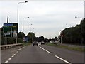
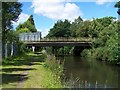
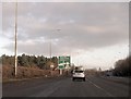
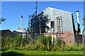
Photos of Four Ashes


Area Information
Four Ashes is a compact built-up area in England, covering 79.6 hectares. It is a small, well-defined community where daily life revolves around local amenities and nearby transport links. The area’s median age of 70 suggests a population skewed toward older residents, though the data does not specify whether this reflects long-term residents or recent demographic shifts. Living in Four Ashes means access to essential services within walking or short driving distance, including multiple retail outlets and railway stations. The area’s proximity to Penkridge, Cannock, and Landywood railway stations connects residents to broader regional networks, making commuting or travel straightforward. For those prioritising convenience, the presence of Co-op stores and Spar outlets ensures basic shopping needs are met. While the data does not provide details on cultural or recreational facilities, the area’s practical layout and infrastructure suggest a focus on functional living over sprawling development. Homes in Four Ashes are predominantly owner-occupied, with 76% of properties in private hands, indicating a stable, long-term resident base. This blend of accessibility, compact size, and established infrastructure defines the character of Four Ashes.
- Area Type
- Built Up Area 250
- Area Size
- 79.6 hectares
- Population
- Not available
- Population Density
- Not available
Living in Four Ashes offers a straightforward lifestyle with essential amenities within practical reach. The area’s retail options include multiple Co-op stores, such as Co-op Coven and Co-op Brewood, alongside a Spar outlet, ensuring basic shopping needs are met without long trips. For transport, five railway stations—Penkridge, Cannock, and Landywood among them—provide regular connections to nearby towns, making commuting or travel convenient. While the data does not mention parks or leisure facilities, the proximity to rail networks and local shops suggests a focus on functional living. The compact nature of the area means residents can access daily essentials without needing a car, fostering a sense of self-sufficiency. The presence of multiple retail outlets and transport links adds to the area’s appeal for those prioritising convenience over sprawling amenities.
Amenities
Schools
| Rank | A + A* % | School | Type | Entry gender | Ages |
|---|
Explore more schools in this area
Go to Schools tabDemographics
The population of Four Ashes has a median age of 70, the highest recorded in the dataset, suggesting a community where older adults form a significant proportion of residents. The most common age range is listed as “Age: Total,” which may indicate that the data aggregates all age groups without further breakdown. Home ownership in the area is high, with 76% of properties owned by their occupants, reflecting a stable housing market. The data does not specify household composition or accommodation types, but the overall figures imply a relatively uniform demographic profile. The predominant ethnic group and religious affiliation are also listed as “total,” meaning no细分 data is available. While this lack of detail limits analysis of cultural diversity, the high home ownership rate and older median age suggest a community with established residency patterns. For prospective buyers, this indicates a low turnover of properties and a focus on long-term living rather than transient populations.
Household Size
Accommodation Type
Tenure
Ethnic Group
Religion
Household Composition
Age
Household Deprivation
NS-SEC
Explore more demographic insights in this area
Go to Demographics tabPlanning
Planning Constraints
- Crime RiskLocked