Area Overview for DY9 9XJ
Photos of DY9 9XJ
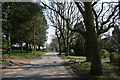

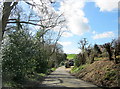
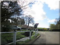

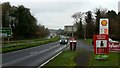

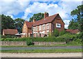
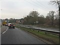
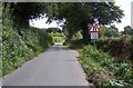

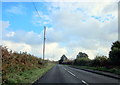
17 photos from this area
Area Information
Key information about the DY9 9XJ including its size, population, and administrative classification.
- Area Type
- Postcode
- Area Size
- 17.1 hectares
- Population
- 1313
- Population Density
- 111 people/km²
House Prices in DY9 9XJ
12
Properties
£375,020
Average Sold Price
£168,550
Lowest Price
£595,000
Highest Price
Showing 12 properties
| Address | Type | Beds | Baths | Last Sale Price | Last Sale Date | |
|---|---|---|---|---|---|---|
| Bell Heath Cottage, Chapel Lane, Belbroughton, DY9 9XJ | Bungalow | 3 | - | £595,000 | Sep 2015 | |
| Rock Cottage, Chapel Lane, Belbroughton, DY9 9XJ | Detached | - | - | £558,000 | Aug 2005 | |
| Lavanda Cottage, Chapel Lane, Belbroughton, DY9 9XJ | house | 4 | 3 | £385,000 | Aug 2004 | |
| The Chapel, Chapel Lane, Belbroughton, DY9 9XJ | undefined | - | - | £168,550 | May 1997 | |
| The Fenn Chapel, Chapel Lane, Belbroughton, DY9 9XJ | Detached | - | - | £168,550 | May 1997 | |
| The Paddock, Chapel Lane, Belbroughton, DY9 9XJ | Detached | 4 | - | - | - | |
| Mobile Home, Rock Cottage, Chapel Lane, Belbroughton, DY9 9XJ | Mobile Home | - | - | - | - | |
| Caravan, Chapel Lane, Belbroughton, DY9 9XJ | Mobile Home | - | - | - | - | |
| Fenn Farm, Chapel Lane, Belbroughton, DY9 9XJ | Detached | - | - | - | - | |
| Holly Bank, Chapel Lane, Belbroughton, DY9 9XJ | Semi-detached | - | - | - | - |
Page 1 of 2
Energy Efficiency in DY9 9XJ
Amenities
Schools
| Rank | School | Type | Entry gender | Ages |
|---|
Explore more schools in this area
Go to Schools tabDemographics
Household Size
Two person
most common
Accommodation Type
Houses
most common
Tenure
89
majority
Ethnic Group
White
most common
Religion
N/A
most common
Household Composition
N/A
most common
Age
47
median
Adults (30-64 years)
most common
Household Deprivation
N/A
with no deprivation
NS-SEC
48
in Lower managerial occupations
Explore more demographic insights in this area
Go to Demographics tabPlanning
Planning Constraints
- Flood RiskPremium
- Ramsar Wetland SitesPremium
- Area of Outstanding Natural BeautyPremium
- Protected Nature ReservePremium
- Protected WoodlandPremium