Area Overview for DY9 9UU
Photos of DY9 9UU
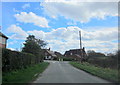
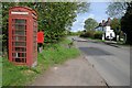
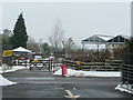
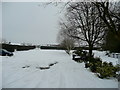
13 photos from this area
Area Information
Key information about the DY9 9UU including its size, population, and administrative classification.
- Area Type
- Postcode
- Area Size
- 53.5 hectares
- Population
- 1154
- Population Density
- 66 people/km²
House Prices in DY9 9UU
19
Properties
£358,000
Average Sold Price
£210,000
Lowest Price
£625,000
Highest Price
Showing 19 properties
| Address | Type | Beds | Baths | Last Sale Price | Last Sale Date | |
|---|---|---|---|---|---|---|
| Hurls Crest, Quantry Lane, Belbroughton, DY9 9UU | Detached | 4 | 2 | £625,000 | Jul 2024 | |
| Lea Bank, Quantry Lane, Belbroughton, DY9 9UU | house | 4 | 2 | £435,000 | Mar 2024 | |
| Cielito Lindo, Quantry Lane, Belbroughton, DY9 9UU | Semi-detached | 3 | 1 | £275,000 | Aug 2022 | |
| Clevedale, Quantry Lane, Belbroughton, DY9 9UU | Detached | 2 | 1 | £210,000 | Sep 2009 | |
| Windy Ridge, Quantry Lane, Belbroughton, DY9 9UU | Detached | 5 | 2 | £287,500 | Aug 2009 | |
| Woodland View, Quantry Lane, Belbroughton, DY9 9UU | house | - | - | £315,500 | Sep 2007 | |
| Staff Quaters, High Bank, Quantry Lane, Belbroughton, DY9 9UU | Detached | 4 | - | - | - | |
| Living Area, Bell Heath Study Centre, Quantry Lane, Belbroughton, DY9 9UU | Detached | 2 | 2 | - | - | |
| Unit 2, Thistle Grove Farm, Quantry Lane, Belbroughton, DY9 9UU | Industrial | - | - | - | - | |
| Unit 2A, Thistle Grove Farm, Quantry Lane, Belbroughton, DY9 9UU | Industrial | - | - | - | - |
Page 1 of 2
Energy Efficiency in DY9 9UU
Amenities
Schools
| Rank | School | Type | Entry gender | Ages |
|---|
Explore more schools in this area
Go to Schools tabDemographics
Household Size
Two person
most common
Accommodation Type
Houses
most common
Tenure
87
majority
Ethnic Group
White
most common
Religion
N/A
most common
Household Composition
N/A
most common
Age
47
median
Adults (30-64 years)
most common
Household Deprivation
N/A
with no deprivation
NS-SEC
40
in Lower managerial occupations
Explore more demographic insights in this area
Go to Demographics tabPlanning
Planning Constraints
- Flood RiskPremium
- Ramsar Wetland SitesPremium
- Area of Outstanding Natural BeautyPremium
- Protected Nature ReservePremium
- Protected WoodlandPremium