Area Overview for DY9 9TW
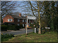
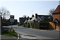
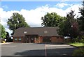
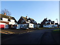
Photos of DY9 9TW

Area Information
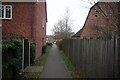
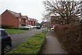
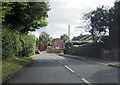
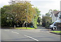
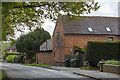
DY9 9TW is a small residential cluster in the village of Belbroughton, Worcestershire, with a population of 1,588 and a density of 187 people per square kilometre. Situated 6 miles north of Bromsgrove and 4 miles south of Stourbridge, it lies at the heart of a historically significant area. The village has roots dating back to AD 817, with remnants of Norman-era architecture and a 16th-century water wheel still standing. Daily life here is shaped by its compact size and proximity to nearby towns, offering a mix of rural charm and practical connectivity. The area is home to a tight-knit community, with 77% of residents owning their homes. Its demographics reflect a mature population, with a median age of 47 and most residents aged 30–64. The village’s character is defined by timber-framed dwellings, conservation areas, and a history tied to scythe-making industries. While it has faced challenges like flooding in 2008, its low crime rates and access to rail networks make it an appealing option for those seeking a stable, family-oriented environment.
- Area Type
- Postcode
- Area Size
- Not available
- Population
- 1588
- Population Density
- 187 people/km²
DY9 9TW is predominantly an owner-occupied area, with 77% of properties owned by residents rather than rented. The accommodation type is primarily houses, which is typical for a small village with limited high-density development. This suggests a market focused on family homes rather than apartments or shared housing. The small size of the area means the housing stock is likely limited, with fewer new builds or rental options. For buyers, this implies a competitive market for existing properties, particularly those in good condition or with historical features like timber framing or listed status. The proximity to rail networks, including Hagley and Stourbridge Junction stations, adds value for commuters. However, the low broadband score (39/100) may be a drawback for those reliant on high-speed internet for work or entertainment. Overall, the property market here is likely to appeal to buyers seeking stability, heritage, and a connection to rural life, though opportunities for investment may be constrained by the area’s size and limited development potential.
House Prices in DY9 9TW
No properties found in this postcode.
Energy Efficiency in DY9 9TW
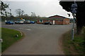
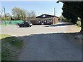
Residents of DY9 9TW have access to a range of local amenities within practical reach. The area includes five retail outlets, such as Morrisons Daily, Co-op Hagley, and Spar, providing everyday shopping needs. These shops offer convenience for groceries, household items, and essentials, reducing the need for long trips to larger centres. The proximity to rail stations also enhances lifestyle options, enabling easy access to nearby towns for dining, entertainment, and leisure. While the data does not specify parks or recreational facilities, the village’s historical and natural features—such as the Belbroughton Conservation Area and glacial boulders—suggest opportunities for outdoor activities. The mix of retail and transport options creates a balanced lifestyle, combining local convenience with regional connectivity. This makes DY9 9TW appealing for those who value self-sufficiency without sacrificing access to broader opportunities.
Amenities
Schools
The nearest school to DY9 9TW is Belbroughton CofE Primary School, which serves the local community with a primary education offering. The school holds a 'good' Ofsted rating, indicating a satisfactory standard of teaching and student outcomes. As the only named school in the data, it suggests that families in the area must rely on this single primary institution for their children’s early education. The absence of secondary schools or additional educational facilities within the immediate vicinity means parents may need to consider commuting to nearby towns for secondary schooling. This could be a factor for families prioritising a comprehensive range of educational options. However, the 'good' rating for the primary school provides a baseline of quality, which may be sufficient for many residents. The limited school infrastructure reflects the village’s small size but also underscores the importance of the existing institution to the local community.
| Rank | School | Type | Entry gender | Ages |
|---|
Explore more schools in this area
Go to Schools tabDemographics
The population of DY9 9TW has a median age of 47, with the majority of residents falling into the 30–64 age range. This suggests a community skewed towards middle-aged adults, likely with established careers and families. Home ownership is high at 77%, indicating a stable, long-term resident base rather than a transient rental market. The predominant accommodation type is houses, which aligns with the village’s traditional layout and limited density. The predominant ethnic group is White, reflecting the area’s historical and demographic continuity. While no specific data on deprivation is provided, the high home ownership and low crime risk (score 81/100) suggest a relatively affluent and secure environment. The absence of detailed diversity metrics means the community’s social composition remains largely homogenous, though this does not necessarily imply a lack of inclusivity. The age profile and ownership rates suggest a focus on family living, with fewer young professionals or retirees compared to other rural areas.
Household Size
Accommodation Type
Tenure
Ethnic Group
Religion
Household Composition
Age
Household Deprivation
NS-SEC
Explore more demographic insights in this area
Go to Demographics tabPlanning
Planning Constraints
- Flood RiskPremium
- Ramsar Wetland SitesPremium
- Area of Outstanding Natural BeautyPremium
- Protected Nature ReservePremium
- Protected WoodlandPremium