Area Overview for DY9 9QF
Photos of DY9 9QF
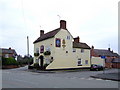
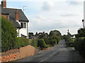
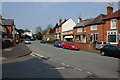
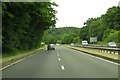

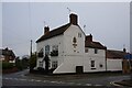
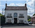
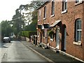
22 photos from this area
Area Information
Key information about the DY9 9QF including its size, population, and administrative classification.
- Area Type
- Postcode
- Area Size
- 4922 m²
- Population
- 1588
- Population Density
- 187 people/km²
House Prices in DY9 9QF
10
Properties
£251,113
Average Sold Price
£17,000
Lowest Price
£399,950
Highest Price
Showing 10 properties
| Address | Type | Beds | Baths | Last Sale Price | Last Sale Date | |
|---|---|---|---|---|---|---|
| Yew Tree Cottage, Bromsgrove Road, Clent, DY9 9QF | Cottage | 1 | 1 | £337,500 | Aug 2022 | |
| Sunnyside, Walton Pool, Clent, DY9 9QF | house | 3 | - | £399,950 | Jun 2021 | |
| 2, Sunrise Cottage, Rock Cottages, Bromsgrove Road, Clent, DY9 9QF | house | - | - | £17,000 | Aug 2019 | |
| Elmdon, Bromsgrove Road, Clent, DY9 9QF | Terraced | 1 | 1 | £250,000 | Oct 2011 | |
| 2, The Rocks, Bromsgrove Road, Clent, DY9 9QF | Semi-detached | - | - | - | - | |
| The Annexe, Barcroft, Bromsgrove Road, Clent, DY9 9QF | Flat | - | - | - | - | |
| 1, Rock Cottages, Bromsgrove Road, Clent, DY9 9QF | Terraced | - | - | - | - | |
| Barcroft, Bromsgrove Road, Clent, DY9 9QF | Detached | - | - | - | - | |
| Cosy Corner, Holy Cross Lane, Holy Cross, DY9 9QF | Terraced | - | - | - | - | |
| The Cottage, Holy Cross Green, Holy Cross, DY9 9QF | Cottage | 1 | - | - | - |
Energy Efficiency in DY9 9QF
Amenities
Schools
| Rank | School | Type | Entry gender | Ages |
|---|
Explore more schools in this area
Go to Schools tabDemographics
Household Size
Family (3-5 people)
most common
Accommodation Type
Houses
most common
Tenure
77
majority
Ethnic Group
White
most common
Religion
N/A
most common
Household Composition
N/A
most common
Age
47
median
Adults (30-64 years)
most common
Household Deprivation
N/A
with no deprivation
NS-SEC
47
in Lower managerial occupations
Explore more demographic insights in this area
Go to Demographics tabPlanning
Planning Constraints
- Flood RiskPremium
- Ramsar Wetland SitesPremium
- Area of Outstanding Natural BeautyPremium
- Protected Nature ReservePremium
- Protected WoodlandPremium