Area Overview for DY9 9AH
Photos of DY9 9AH
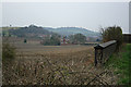
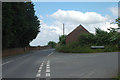
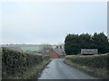
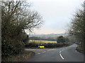
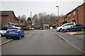
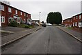
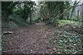
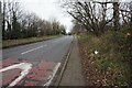
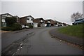

21 photos from this area
Area Information
Key information about the DY9 9AH including its size, population, and administrative classification.
- Area Type
- Postcode
- Area Size
- 4.7 hectares
- Population
- 1694
- Population Density
- 2271 people/km²
House Prices in DY9 9AH
23
Properties
£120,761
Average Sold Price
£37,000
Lowest Price
£210,000
Highest Price
Showing 23 properties
| Address | Type | Beds | Baths | Last Sale Price | Last Sale Date | |
|---|---|---|---|---|---|---|
| 28 Wynall Lane South, Wollescote, DY9 9AH | house | - | - | £210,000 | Apr 2021 | |
| 40 Wynall Lane South, Wollescote, DY9 9AH | house | - | - | £155,000 | Aug 2019 | |
| 26 Wynall Lane South, Wollescote, DY9 9AH | Semi-detached | 3 | 1 | £180,000 | Feb 2019 | |
| 32 Wynall Lane South, Wollescote, DY9 9AH | Semi-detached | 2 | 1 | £140,000 | Mar 2017 | |
| 4 Wynall Lane South, Wollescote, DY9 9AH | Semi-detached | 3 | - | £70,000 | Jan 2014 | |
| 30 Wynall Lane South, Wollescote, DY9 9AH | house | - | - | £87,500 | Sep 2012 | |
| 1 Wynall Lane South, Wollescote, DY9 9AH | house | - | - | £151,000 | May 2011 | |
| 2 Wynall Lane South, Wollescote, DY9 9AH | Semi-detached | - | - | £56,350 | May 2001 | |
| 38 Wynall Lane South, Wollescote, DY9 9AH | house | - | - | £37,000 | Jun 2000 | |
| 34 Wynall Lane South, Wollescote, DY9 9AH | Terraced | - | - | - | - |
Page 1 of 3
Energy Efficiency in DY9 9AH
Amenities
Schools
| Rank | School | Type | Entry gender | Ages |
|---|
Explore more schools in this area
Go to Schools tabDemographics
Household Size
Family (3-5 people)
most common
Accommodation Type
Houses
most common
Tenure
67
majority
Ethnic Group
White
most common
Religion
N/A
most common
Household Composition
N/A
most common
Age
47
median
Adults (30-64 years)
most common
Household Deprivation
N/A
with no deprivation
NS-SEC
21
in Lower managerial occupations
Explore more demographic insights in this area
Go to Demographics tabPlanning
Planning Constraints
- Flood RiskPremium
- Ramsar Wetland SitesPremium
- Area of Outstanding Natural BeautyPremium
- Protected Nature ReservePremium
- Protected WoodlandPremium