Area Overview for DY9 8YZ
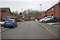
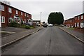
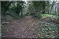
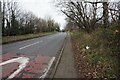
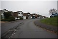
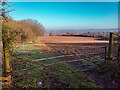
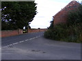
Photos of DY9 8YZ

Area Information
DY9 8YZ lies in the heart of Cradley North & Wollescote, a suburban district in Dudley, West Midlands, with a population of around 1,724. This small postcode area blends post-WWII housing estates with historic roots, situated three miles east of Stourbridge town centre. The area is part of the former Black Country region, known for its industrial heritage, yet today it offers a quieter, residential lifestyle. Wollescote, a hamlet with origins tracing back to the 13th century, now features modern housing alongside community spaces like Wollescote Park. Cradley, meanwhile, has been integrated into Halesowen through decades of development, with a mix of low-rise homes and former tower blocks. The area’s proximity to Stourbridge and surrounding towns ensures easy access to amenities, while its compact size fosters a close-knit community. With a median age of 47 and a population skewed toward adults aged 30–64, DY9 8YZ is a stable, mature neighbourhood where historical and contemporary elements coexist.
- Area Type
- Postcode
- Area Size
- Not available
- Population
- 1724
- Population Density
- 4373 people/km²
The property market in DY9 8YZ is characterised by a high rate of home ownership (69%) and a predominance of houses over flats or apartments. This suggests a community where owner-occupation is the norm, with properties ranging from post-war council homes to private residences. The area’s compact size means the housing stock is limited, potentially leading to competition for available homes. The mix of low-rise houses and former tower blocks, particularly in areas like Cradley, indicates a blend of older and newer housing stock. For buyers, this means a focus on family-sized homes in a suburban setting, though the small postcode area may require looking beyond immediate surroundings for additional options. The high home ownership rate also implies a stable market, with properties likely retaining value due to the area’s historical significance and proximity to Stourbridge.
House Prices in DY9 8YZ
No properties found in this postcode.
Energy Efficiency in DY9 8YZ
Daily life in DY9 8YZ is shaped by its proximity to retail, leisure, and community spaces. The area has five notable retail outlets, including Tesco Lye, Aldi Dudley, and Spar, offering essential shopping and convenience services. Nearby rail stations provide access to Stourbridge and beyond, while the area’s historic parks and green spaces, such as Wollescote Park, offer recreational opportunities. Community hubs like Wollescote Hall, a historic site used by local groups, add to the area’s character. The mix of low-rise housing and redeveloped parkland creates a balance between suburban comfort and green spaces. Residents can enjoy a blend of practical amenities and historical landmarks, making DY9 8YZ a place where everyday life is both convenient and rooted in local heritage.
Amenities
Schools
The nearest school to DY9 8YZ is Wollescote Primary School, a state-funded primary institution with an Ofsted rating of “good.” This school serves the local community, providing education for younger children in the area. While no secondary schools are listed in the data, the presence of a well-rated primary school is a significant draw for families. The school’s “good” rating suggests a reliable standard of education, though parents seeking secondary options may need to look further afield. The absence of additional schools in the immediate vicinity means that families should consider proximity to other educational institutions when evaluating the area.
| Rank | School | Type | Entry gender | Ages |
|---|
Explore more schools in this area
Go to Schools tabDemographics
The population of DY9 8YZ is 1,724, with a median age of 47 and the majority of residents aged between 30 and 64. Home ownership is high at 69%, reflecting a community of long-term residents rather than transient renters. The predominant accommodation type is houses, suggesting a family-oriented demographic. The predominant ethnic group is White, though specific data on diversity is not provided. This age profile indicates a mature population, likely with established careers and families, contributing to a stable local economy. The absence of detailed deprivation data means that while the area’s safety and connectivity are strong, the broader socioeconomic context remains less defined. However, the high home ownership rate and moderate age range suggest a community with a focus on long-term residency and local investment.
Household Size
Accommodation Type
Tenure
Ethnic Group
Religion
Household Composition
Age
Household Deprivation
NS-SEC
Explore more demographic insights in this area
Go to Demographics tabPlanning
Planning Constraints
- Flood RiskPremium
- Ramsar Wetland SitesPremium
- Area of Outstanding Natural BeautyPremium
- Protected Nature ReservePremium
- Protected WoodlandPremium