Area Overview for DY9 8YT
Photos of DY9 8YT


Area Information
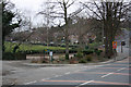
DY9 8YT lies within the Dudley metropolitan borough in the West Midlands, a small residential cluster nestled in the historic Black Country region. With a population of around 1,724, it is a tight-knit community bordered by Halesowen to the east and areas like Lye and Cradley to the west. The area’s character blends suburban living with historical roots, including Wollescote, a hamlet first mentioned in 1282, and Cradley, home to Wollescote Hall—a 16th-century estate now used by local community groups. Residents live within easy reach of Stourbridge town centre, about three miles west, and benefit from proximity to nearby towns such as Halesowen. The area’s mix of low-rise housing, former tower blocks, and redeveloped parkland reflects its 20th-century evolution. Daily life here is shaped by local amenities, including retail outlets like Tesco Lye and Aldi Dudley, and access to railway stations such as Lye and Stourbridge Junction. The presence of Wollescote Primary School, rated good by Ofsted, adds to the appeal for families seeking a balanced mix of convenience and community.
- Area Type
- Postcode
- Area Size
- Not available
- Population
- 1724
- Population Density
- 4373 people/km²
DY9 8YT is primarily an owner-occupied area, with 69% of homes owned by residents rather than rented. The accommodation type is predominantly houses, which is typical for suburban regions in the West Midlands. This suggests a market skewed towards family homes rather than high-density housing or rental properties. Given the small size of the postcode area, the housing stock is limited, and buyers may need to consider nearby suburbs such as Lye or Cradley for additional options. The presence of both private and former council housing indicates a mix of property ages and conditions, though the area’s low flood risk and absence of planning constraints like protected woodlands or AONB designations make it an attractive option for those seeking stable, long-term investment. For buyers, the focus on houses rather than flats may appeal to those prioritising space and garden access, though the market’s small scale means competition could be fierce for available properties.
House Prices in DY9 8YT
No properties found in this postcode.
Energy Efficiency in DY9 8YT
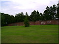
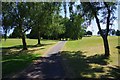
Residents of DY9 8YT have access to a range of amenities within practical reach. Retail options include five notable stores such as Tesco Lye, Aldi Dudley, and Spar, providing everyday shopping convenience. The area’s railway stations—Lye, Stourbridge Junction, and Cradley Heath—offer connections to nearby towns and cities, enhancing mobility. While specific parks or leisure facilities are not listed in the data, the historical presence of Wollescote Park and community groups like Friends of Wollescote Park suggests recreational opportunities. The area’s suburban character, with redeveloped parkland and low-rise housing, supports a lifestyle that balances convenience with a sense of space. The presence of Wollescote Primary School and local shops indicates a focus on family-friendly amenities, though larger retail or entertainment options would require travel to Stourbridge or Halesowen.
Amenities
Schools
The nearest school to DY9 8YT is Wollescote Primary School, which serves the local community with a good Ofsted rating. This school is a key asset for families, offering primary education within walking distance of many homes. The absence of secondary schools in the immediate area means students may need to travel to nearby towns such as Stourbridge or Halesowen for further education. The single primary school available reflects the area’s small size and the concentration of younger families in the demographic. While the good rating at Wollescote Primary suggests a reliable standard of education, prospective buyers should consider the need for additional schooling options beyond primary level. The school’s presence also contributes to the area’s community feel, with parents and children frequently interacting in local amenities and events.
| Rank | School | Type | Entry gender | Ages |
|---|
Explore more schools in this area
Go to Schools tabDemographics
The population of DY9 8YT is predominantly adults aged 30–64, with a median age of 47. Home ownership is high, at 69%, and the area is characterised by a majority of houses rather than flats. The predominant ethnic group is White, reflecting the region’s historical demographics. This age profile suggests a stable community with a focus on long-term residency rather than transient populations. The absence of specific data on deprivation means that quality of life is inferred from the availability of local services and infrastructure. The area’s older demographic may contribute to a quieter, more established social environment, though the presence of nearby railway stations and retail amenities indicates accessibility for younger families and commuters. The lack of significant diversity data does not detract from the practical advantages of living in an area with well-established housing stock and community institutions.
Household Size
Accommodation Type
Tenure
Ethnic Group
Religion
Household Composition
Age
Household Deprivation
NS-SEC
Explore more demographic insights in this area
Go to Demographics tabPlanning
Planning Constraints
- Flood RiskPremium
- Ramsar Wetland SitesPremium
- Area of Outstanding Natural BeautyPremium
- Protected Nature ReservePremium
- Protected WoodlandPremium