Area Overview for DY9 8UT
Photos of DY9 8UT

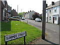
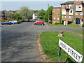
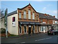
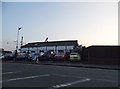
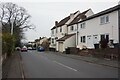
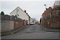
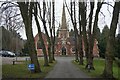
90 photos from this area
Area Information
Key information about the DY9 8UT including its size, population, and administrative classification.
- Area Type
- Postcode
- Area Size
- 1.6 hectares
- Population
- 1567
- Population Density
- 3117 people/km²
House Prices in DY9 8UT
68
Properties
£95,032
Average Sold Price
£16,000
Lowest Price
£175,000
Highest Price
Showing 68 properties
| Address | Type | Beds | Baths | Last Sale Price | Last Sale Date | |
|---|---|---|---|---|---|---|
| 27 King Street, Lye, DY9 8UT | Terraced | 2 | 1 | £175,000 | Sep 2025 | |
| 5 King Street, Lye, DY9 8UT | Terraced | 2 | 1 | £144,300 | Jul 2025 | |
| 25A King Street, Lye, DY9 8UT | Terraced | 2 | 1 | £170,000 | Jun 2025 | |
| 1 King Street, Lye, DY9 8UT | Terraced | 2 | 1 | £105,000 | Apr 2025 | |
| 26 King Street, Lye, DY9 8UT | Terraced | 2 | 1 | £165,000 | Jun 2024 | |
| 9 King Street, Lye, DY9 8UT | Terraced | 2 | 1 | £128,000 | Jan 2024 | |
| 32 King Street, Lye, DY9 8UT | Terraced | 2 | 1 | £139,500 | Feb 2021 | |
| 38 King Street, Lye, DY9 8UT | house | - | - | £68,000 | Sep 2019 | |
| 27A King Street, Lye, DY9 8UT | Terraced | 2 | 1 | £123,000 | Sep 2019 | |
| 45 King Street, Lye, DY9 8UT | Detached | 3 | 1 | £151,000 | Oct 2018 |
Page 1 of 7
Energy Efficiency in DY9 8UT
Amenities
Schools
| Rank | School | Type | Entry gender | Ages |
|---|
Explore more schools in this area
Go to Schools tabDemographics
Household Size
Family (3-5 people)
most common
Accommodation Type
Houses
most common
Tenure
53
majority
Ethnic Group
asian_total
most common
Religion
N/A
most common
Household Composition
N/A
most common
Age
47
median
Adults (30-64 years)
most common
Household Deprivation
N/A
with no deprivation
NS-SEC
15
in Lower managerial occupations
Explore more demographic insights in this area
Go to Demographics tabPlanning
Planning Constraints
- Flood RiskPremium
- Ramsar Wetland SitesPremium
- Area of Outstanding Natural BeautyPremium
- Protected Nature ReservePremium
- Protected WoodlandPremium