Area Overview for DY9 8TE
Photos of DY9 8TE
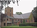
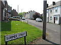
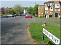
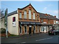
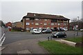
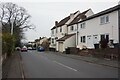
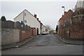
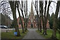
90 photos from this area
Area Information
Key information about the DY9 8TE including its size, population, and administrative classification.
- Area Type
- Postcode
- Area Size
- 2842 m²
- Population
- 1567
- Population Density
- 3117 people/km²
House Prices in DY9 8TE
10
Properties
£79,167
Average Sold Price
£51,000
Lowest Price
£116,500
Highest Price
Showing 10 properties
| Address | Type | Beds | Baths | Last Sale Price | Last Sale Date | |
|---|---|---|---|---|---|---|
| 72 Balds Lane, Lye, DY9 8TE | house | - | - | £70,000 | Oct 2006 | |
| 73 Balds Lane, Lye, DY9 8TE | Terraced | 3 | 1 | £116,500 | Oct 2005 | |
| 71 Balds Lane, Lye, DY9 8TE | Semi-detached | 3 | 1 | £51,000 | May 1999 | |
| Theatre Tees, Unit I2, Monarch Works, Balds Lane, Lye, DY9 8TE | Office | - | - | - | - | |
| Network It Systems Limited, Unit I1, Monarch Works, Balds Lane, Lye, DY9 8TE | Office | - | - | - | - | |
| Concept Covers Ltd, Unit L, Monarch Works, Balds Lane, Lye, DY9 8TE | warehouse | - | - | - | - | |
| Concept Covers Ltd, Unit M, Monarch Works, Balds Lane, Lye, DY9 8TE | Industrial | - | - | - | - | |
| M & M Bodycraft, Unit 4, Monarch Works, Balds Lane, Lye, DY9 8TE | office_workshop | - | - | - | - | |
| Brassart Ltd, Units A And B, Monarch Works, Balds Lane, Lye, DY9 8TE | Industrial | - | - | - | - | |
| 74 Balds Lane, Lye, DY9 8TE | house | - | - | - | - |
Energy Efficiency in DY9 8TE
Amenities
Schools
| Rank | School | Type | Entry gender | Ages |
|---|
Explore more schools in this area
Go to Schools tabDemographics
Household Size
Family (3-5 people)
most common
Accommodation Type
Houses
most common
Tenure
53
majority
Ethnic Group
asian_total
most common
Religion
N/A
most common
Household Composition
N/A
most common
Age
47
median
Adults (30-64 years)
most common
Household Deprivation
N/A
with no deprivation
NS-SEC
15
in Lower managerial occupations
Explore more demographic insights in this area
Go to Demographics tabPlanning
Planning Constraints
- Flood RiskPremium
- Ramsar Wetland SitesPremium
- Area of Outstanding Natural BeautyPremium
- Protected Nature ReservePremium
- Protected WoodlandPremium