Area Overview for DY9 8PR
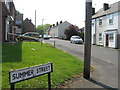
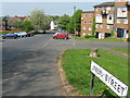
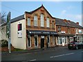
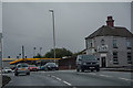
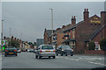
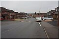
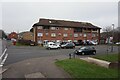
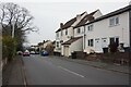
Photos of DY9 8PR


Area Information
DY9 8PR is a compact residential cluster in England, covering just 3,180 square metres and home to 1,567 people. Its population density of 492,844 per square kilometre reflects a tightly woven community, where proximity to amenities and services is a defining feature. This postcode area is characterised by a mix of single-family homes, with a strong emphasis on owner-occupation — 53% of residents own their homes. The area’s demographic profile is notable: the median age is 47, with the majority of residents aged between 30 and 64. The predominant ethnic group is Asian, shaping a culturally distinct neighbourhood. Daily life here is shaped by its strategic location, offering easy access to retail, rail, and metro networks. Residents benefit from a blend of practicality and connectivity, with local shops and transport hubs within walking distance. While the area is small, its infrastructure is robust, making it appealing to those seeking a balance between suburban comfort and urban accessibility.
- Area Type
- Postcode
- Area Size
- 3180 m²
- Population
- 1567
- Population Density
- 3117 people/km²
The property market in DY9 8PR is dominated by owner-occupied homes, with 53% of residents owning their properties. The accommodation type is exclusively houses, indicating a lack of high-density housing such as flats or apartments. This suggests a market skewed towards single-family homes, likely appealing to families or individuals seeking space and privacy. Given the area’s small size, the housing stock is limited, which may mean competition for available properties. Buyers should consider the proximity to rail and metro networks, as these provide access to larger urban centres. The predominance of houses also implies that the area is not a rental hotspot, though the exact proportion of rental properties is unspecified. For those seeking a home in DY9 8PR, the focus is on securing a standalone property in a compact, well-connected neighbourhood. The market’s character is defined by its residential exclusivity and the absence of commercial or mixed-use developments.
House Prices in DY9 8PR
No properties found in this postcode.
Energy Efficiency in DY9 8PR
Living in DY9 8PR offers a practical blend of retail, transport, and community amenities. Local shops such as Aldi Dudley, Tesco Lye, and Lidl Cradley provide everyday essentials, reducing the need for long trips to larger centres. The area’s rail and metro stations — including Lye, Cradley Heath, and Stourbridge Junction — connect residents to broader networks, facilitating travel to work, education, or social events. While parks and green spaces are not explicitly mentioned, the absence of environmental constraints like AONB or protected woodlands suggests open land may be available for leisure. The compact nature of the area means amenities are within walking distance, fostering a convenient, self-contained lifestyle. This mix of retail, transport, and accessibility makes DY9 8PR suitable for those prioritising practicality and ease of movement without sacrificing the benefits of a residential community.
Amenities
Schools
| Rank | School | Type | Entry gender | Ages |
|---|
Explore more schools in this area
Go to Schools tabDemographics
The community in DY9 8PR is predominantly composed of adults aged 30 to 64, with a median age of 47. This suggests a mature, stable population, likely with established careers and families. Home ownership stands at 53%, indicating a mix of owner-occupied properties and rental units. The accommodation type is primarily houses, reflecting a preference for standalone homes over flats or apartments. The area’s demographic diversity is marked by the Asian_total group being the largest ethnic cohort, contributing to a distinct cultural landscape. The high population density — 492,844 people per square kilometre — implies a closely knit community, though the small area size means residents are likely to know their neighbours. This density, combined with the age profile, suggests a focus on family-oriented living, with services and amenities tailored to middle-aged adults. The data does not indicate significant deprivation, but the lack of detailed socioeconomic metrics means broader quality-of-life implications remain unexplored.
Household Size
Accommodation Type
Tenure
Ethnic Group
Religion
Household Composition
Age
Household Deprivation
NS-SEC
Explore more demographic insights in this area
Go to Demographics tabPlanning
Planning Constraints
- Flood RiskPremium
- Ramsar Wetland SitesPremium
- Area of Outstanding Natural BeautyPremium
- Protected Nature ReservePremium
- Protected WoodlandPremium