Area Overview for DY9 8BQ
Photos of DY9 8BQ


Area Information
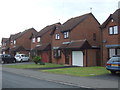
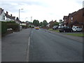
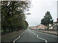
Living in DY9 8BQ means inhabiting a compact, densely populated residential cluster in England. The area covers just 1.0 hectare, housing 1,720 people in a space that translates to a population density of 167,001 people per square kilometre. This makes it one of the most densely populated areas in the country, with homes closely spaced and community life likely to be tightly knit. The area is characterised by its small-scale, residential focus, with no large commercial or industrial zones nearby. Residents benefit from proximity to multiple rail stations, including Lye and Cradley Heath, and nearby retail hubs like Aldi Dudley and Tesco Lye. Daily life here is shaped by the need for efficient local services, with shops, transport, and amenities all within practical reach. The high population density suggests a mature community, with a median age of 47 and a strong presence of adults aged 30–64. This is a place where convenience and accessibility are prioritised, though the small footprint means space is at a premium.
- Area Type
- Postcode
- Area Size
- 1.0 hectares
- Population
- 1720
- Population Density
- 2583 people/km²
The property market in DY9 8BQ is defined by high home ownership rates—75% of residents own their homes—and a focus on single-family houses. This suggests a market where property is primarily owner-occupied rather than rental-based, with limited availability of apartments or flats. The small area size (1.0 hectare) means the housing stock is constrained, potentially making the local market competitive for buyers. The predominance of houses indicates a demand for traditional, family-oriented homes, which may appeal to those seeking stability and space. However, the high population density—167,001 people per square kilometre—means properties are closely spaced, and buyers must consider proximity to neighbours and shared infrastructure. For those looking to purchase in DY9 8BQ, the immediate surroundings offer access to rail and metro stations, retail, and essential services, though the area’s compact nature means expansion options are limited.
House Prices in DY9 8BQ
Showing 2 properties
| Address | Type | Beds | Baths | Last Sale Price | Last Sale Date | |
|---|---|---|---|---|---|---|
| Scott Young Research (syr), Dudley Road, Lye, DY9 8BQ | warehouse | - | - | - | - | |
| J&m Refrigeration, Hawthorn House, Dudley Road, Lye, DY9 8BQ | office_workshop | - | - | - | - |
Energy Efficiency in DY9 8BQ
Residents of DY9 8BQ have access to a range of nearby amenities within practical reach, shaping a lifestyle that balances convenience with local character. Retail options include Aldi Dudley, Tesco Lye, and Sainsburys Amblecote, providing essential shopping and grocery needs without requiring long journeys. The area’s rail and metro stations—Lye, Cradley Heath, Stourbridge Town, and others—connect residents to broader networks, enabling easy access to workplaces, cultural attractions, and services beyond the immediate vicinity. While the area itself is small, its proximity to these amenities ensures daily life is efficient, with minimal need to travel far for necessities. The presence of multiple transport hubs and retail options suggests a community designed for practicality, where convenience is prioritised. However, the compact nature of DY9 8BQ means residents must navigate a densely packed environment, where space is limited but services are readily available.
Amenities
Schools
| Rank | School | Type | Entry gender | Ages |
|---|
Explore more schools in this area
Go to Schools tabDemographics
The community in DY9 8BQ is predominantly composed of adults aged 30–64, with a median age of 47. This suggests a mature, stable population, likely with established careers and families. Home ownership is high, with 75% of residents owning their homes, compared to 25% renting. The accommodation type is primarily houses, reflecting a residential area with a focus on single-family dwellings rather than flats or apartments. The predominant ethnic group is White, which aligns with broader demographic trends in the region. The area’s population density of 167,001 people per square kilometre is exceptionally high, indicating a compact, densely inhabited space where proximity to neighbours is inevitable. This density may influence the character of daily life, fostering a sense of community but also potentially limiting personal space. The lack of specific data on deprivation means the quality of life must be inferred from the available figures, which suggest a settled, middle-aged population with strong ties to home ownership and local amenities.
Household Size
Accommodation Type
Tenure
Ethnic Group
Religion
Household Composition
Age
Household Deprivation
NS-SEC
Explore more demographic insights in this area
Go to Demographics tabPlanning
Planning Constraints
- Flood RiskPremium
- Ramsar Wetland SitesPremium
- Area of Outstanding Natural BeautyPremium
- Protected Nature ReservePremium
- Protected WoodlandPremium