Area Overview for DY9 8BG
Photos of DY9 8BG
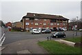
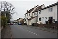
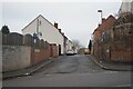
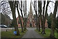
90 photos from this area
Area Information
Key information about the DY9 8BG including its size, population, and administrative classification.
- Area Type
- Postcode
- Area Size
- 5010 m²
- Population
- 1926
- Population Density
- 2758 people/km²
House Prices in DY9 8BG
17
Properties
£76,000
Average Sold Price
£50,000
Lowest Price
£145,000
Highest Price
Showing 17 properties
| Address | Type | Beds | Baths | Last Sale Price | Last Sale Date | |
|---|---|---|---|---|---|---|
| 42 Cross Walks, Lye, DY9 8BG | Terraced | - | - | £80,000 | Apr 2019 | |
| 34 Cross Walks, Lye, DY9 8BG | house | - | - | £145,000 | Oct 2016 | |
| 43 Cross Walks, Lye, DY9 8BG | house | - | - | £70,000 | Sep 2013 | |
| 40 Cross Walks, Lye, DY9 8BG | Terraced | - | - | £100,000 | Apr 2006 | |
| 31 Cross Walks, Lye, DY9 8BG | Terraced | - | - | £54,000 | Jan 2002 | |
| 39 Cross Walks, Lye, DY9 8BG | Terraced | - | - | £54,500 | Jan 2001 | |
| 41 Cross Walks, Lye, DY9 8BG | Terraced | - | - | £54,500 | Jan 2001 | |
| 33 Cross Walks, Lye, DY9 8BG | Terraced | - | - | £50,000 | Apr 1999 | |
| 29 Cross Walks, Lye, DY9 8BG | house | - | - | - | - | |
| 36 Cross Walks, Lye, DY9 8BG | house | - | - | - | - |
Page 1 of 2
Energy Efficiency in DY9 8BG
Amenities
Schools
| Rank | School | Type | Entry gender | Ages |
|---|
Explore more schools in this area
Go to Schools tabDemographics
Household Size
One person
most common
Accommodation Type
Flats
most common
Tenure
24
majority
Ethnic Group
White
most common
Religion
N/A
most common
Household Composition
N/A
most common
Age
47
median
Adults (30-64 years)
most common
Household Deprivation
N/A
with no deprivation
NS-SEC
16
in Lower managerial occupations
Explore more demographic insights in this area
Go to Demographics tabPlanning
Planning Constraints
- Flood RiskPremium
- Ramsar Wetland SitesPremium
- Area of Outstanding Natural BeautyPremium
- Protected Nature ReservePremium
- Protected WoodlandPremium