Area Overview for DY9 7EY
Photos of DY9 7EY
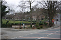
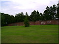


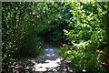


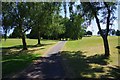

38 photos from this area
Area Information
Key information about the DY9 7EY including its size, population, and administrative classification.
- Area Type
- Postcode
- Area Size
- 4.1 hectares
- Population
- 1446
- Population Density
- 2650 people/km²
House Prices in DY9 7EY
33
Properties
£234,179
Average Sold Price
£65,000
Lowest Price
£395,000
Highest Price
Showing 33 properties
| Address | Type | Beds | Baths | Last Sale Price | Last Sale Date | |
|---|---|---|---|---|---|---|
| 45 Croftwood Road, Wollescote, DY9 7EY | Detached | 3 | 2 | £395,000 | Sep 2025 | |
| 61 Croftwood Road, Wollescote, DY9 7EY | house | - | - | £300,000 | Jul 2022 | |
| 60 Croftwood Road, Wollescote, DY9 7EY | house | 3 | 1 | £310,000 | Apr 2022 | |
| 46 Croftwood Road, Wollescote, DY9 7EY | Detached | 4 | 1 | £375,000 | Apr 2021 | |
| 50 Croftwood Road, Wollescote, DY9 7EY | Detached | 4 | 1 | £300,000 | Dec 2020 | |
| 39 Croftwood Road, Wollescote, DY9 7EY | house | - | - | £234,000 | Nov 2020 | |
| 47 Croftwood Road, Wollescote, DY9 7EY | Detached | 3 | 2 | £225,000 | Nov 2016 | |
| 57 Croftwood Road, Wollescote, DY9 7EY | Detached | 3 | - | £215,000 | Oct 2014 | |
| 69 Croftwood Road, Wollescote, DY9 7EY | house | - | - | £162,000 | Nov 2011 | |
| 40 Croftwood Road, Wollescote, DY9 7EY | Semi-detached | - | - | £162,000 | Jul 2009 |
Page 1 of 4
Energy Efficiency in DY9 7EY
Amenities
Schools
| Rank | School | Type | Entry gender | Ages |
|---|
Explore more schools in this area
Go to Schools tabDemographics
Household Size
One person
most common
Accommodation Type
Houses
most common
Tenure
52
majority
Ethnic Group
White
most common
Religion
N/A
most common
Household Composition
N/A
most common
Age
47
median
Adults (30-64 years)
most common
Household Deprivation
N/A
with no deprivation
NS-SEC
19
in Lower managerial occupations
Explore more demographic insights in this area
Go to Demographics tabPlanning
Planning Constraints
- Flood RiskPremium
- Ramsar Wetland SitesPremium
- Area of Outstanding Natural BeautyPremium
- Protected Nature ReservePremium
- Protected WoodlandPremium