Area Overview for DY9 7BT
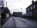
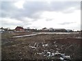
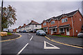
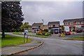
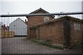
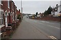
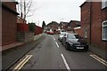
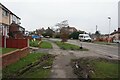
Photos of DY9 7BT

Area Information
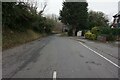
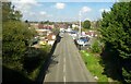
DY9 7BT is a small, tightly knit residential area in England, home to 1655 residents. Its compact size fosters a quiet, community-focused atmosphere, with most properties being houses rather than flats. The area’s population skews towards adults aged 30–64, reflecting a mature demographic that likely values stability and established local services. Daily life here is shaped by proximity to nearby towns and amenities, with residents benefiting from a mix of practical infrastructure. The postcode covers a limited geographical footprint, making it ideal for those seeking a low-maintenance lifestyle without sacrificing access to essential services. Local landmarks include Rufford Primary School, which serves the area’s children, and a network of railway stations that connect residents to broader regional hubs. While the community is small, it offers a blend of residential comfort and functional connectivity, appealing to families and professionals alike.
- Area Type
- Postcode
- Area Size
- Not available
- Population
- 1655
- Population Density
- 4424 people/km²
DY9 7BT is predominantly an owner-occupied area, with 57% of properties owned by residents rather than rented. The housing stock is composed mainly of houses, which suggests a focus on family homes and a more traditional residential layout. This contrasts with areas dominated by flats or rental properties, where turnover is typically higher. The limited size of the postcode means the housing market here is relatively small, with fewer options for buyers compared to larger towns. However, the presence of houses may appeal to those seeking space and privacy. For buyers, this could mean a stable market with fewer speculative risks, though competition for available properties may be intense. Those considering the area should also look to nearby postcodes for additional options, as the immediate vicinity offers a limited range of homes.
House Prices in DY9 7BT
No properties found in this postcode.
Energy Efficiency in DY9 7BT
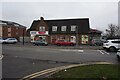
The lifestyle in DY9 7BT is shaped by its proximity to practical amenities. Retail options include Aldi Dudley, Tesco Lye, and Aldi New, providing access to groceries, household goods, and everyday essentials. The rail network, with stations such as Lye and Stourbridge Junction, offers easy access to nearby towns, supporting both commuting and leisure activities. While the area lacks detailed information on parks or leisure facilities, the presence of retail and transport hubs suggests a focus on functionality over expansive recreational spaces. The community’s character is defined by its quiet residential nature, with local services catering to daily needs without the bustle of larger urban centres. For those prioritising convenience and connectivity, DY9 7BT offers a straightforward, no-frills approach to living.
Amenities
Schools
Rufford Primary School is the sole educational institution explicitly listed for DY9 7BT, serving the area’s primary school needs. The school is rated ‘good’ by Ofsted, indicating a satisfactory standard of education. As a primary school, it caters to children aged 4–11, making it a critical resource for families with young dependents. The absence of secondary schools in the data suggests that students may need to travel to nearby towns for further education, though the proximity to rail stations could ease this transition. The single primary school in the area reflects a modest educational infrastructure, which may be sufficient for local families but could limit choices for those requiring specialist provisions or larger school environments.
| Rank | School | Type | Entry gender | Ages |
|---|
Explore more schools in this area
Go to Schools tabDemographics
The population of DY9 7BT has a median age of 47, with the majority of residents falling within the 30–64 age range. This suggests a community of established professionals and families, rather than students or younger singles. Home ownership stands at 57%, indicating a balance between owner-occupied properties and rental units. The predominant accommodation type is houses, which aligns with the area’s residential character. The predominant ethnic group is White, reflecting a homogenous demographic profile. While no specific data on deprivation is provided, the age distribution and home ownership rate imply a relatively stable socioeconomic environment. The absence of detailed diversity metrics means the community’s cultural composition remains less defined, but the data underscores a focus on traditional family living and long-term residency.
Household Size
Accommodation Type
Tenure
Ethnic Group
Religion
Household Composition
Age
Household Deprivation
NS-SEC
Explore more demographic insights in this area
Go to Demographics tabPlanning
Planning Constraints
- Flood RiskPremium
- Ramsar Wetland SitesPremium
- Area of Outstanding Natural BeautyPremium
- Protected Nature ReservePremium
- Protected WoodlandPremium