Area Overview for DY9 7AU
Photos of DY9 7AU
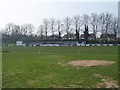
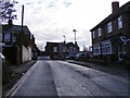
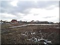
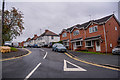
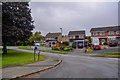
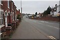
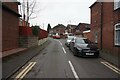
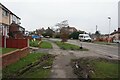
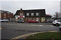
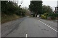
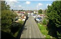
48 photos from this area
Area Information
Key information about the DY9 7AU including its size, population, and administrative classification.
- Area Type
- Postcode
- Area Size
- 7169 m²
- Population
- 1655
- Population Density
- 4424 people/km²
House Prices in DY9 7AU
20
Properties
£139,032
Average Sold Price
£35,000
Lowest Price
£249,950
Highest Price
Showing 20 properties
| Address | Type | Beds | Baths | Last Sale Price | Last Sale Date | |
|---|---|---|---|---|---|---|
| 47 Bagley Street, Lye, DY9 7AU | Semi-detached | 2 | 1 | £180,000 | Oct 2024 | |
| 46 Bagley Street, Lye, DY9 7AU | Semi-detached | 2 | 1 | £196,000 | Sep 2023 | |
| 39 Bagley Street, Lye, DY9 7AU | Terraced | 2 | 1 | £175,000 | Sep 2023 | |
| 53 Bagley Street, Lye, DY9 7AU | Terraced | 2 | - | £185,000 | Aug 2022 | |
| 57 Bagley Street, Lye, DY9 7AU | Terraced | 2 | 1 | £132,000 | Nov 2020 | |
| 33 Bagley Street, Lye, DY9 7AU | Detached | 4 | - | £249,950 | Oct 2020 | |
| 41 Bagley Street, Lye, DY9 7AU | Terraced | 2 | 1 | £160,000 | Jun 2020 | |
| 40 Bagley Street, Lye, DY9 7AU | Terraced | 2 | - | £104,000 | Jun 2015 | |
| 48 Bagley Street, Lye, DY9 7AU | Semi-detached | 2 | 1 | £122,500 | Jan 2015 | |
| 42 Bagley Street, Lye, DY9 7AU | Terraced | 2 | 1 | £89,000 | Jul 2014 |
Page 1 of 2
Energy Efficiency in DY9 7AU
Amenities
Schools
| Rank | School | Type | Entry gender | Ages |
|---|
Explore more schools in this area
Go to Schools tabDemographics
Household Size
One person
most common
Accommodation Type
Houses
most common
Tenure
57
majority
Ethnic Group
White
most common
Religion
N/A
most common
Household Composition
N/A
most common
Age
47
median
Adults (30-64 years)
most common
Household Deprivation
N/A
with no deprivation
NS-SEC
21
in Lower managerial occupations
Explore more demographic insights in this area
Go to Demographics tabPlanning
Planning Constraints
- Flood RiskPremium
- Ramsar Wetland SitesPremium
- Area of Outstanding Natural BeautyPremium
- Protected Nature ReservePremium
- Protected WoodlandPremium