Area Overview for DY9 0QS
Photos of DY9 0QS
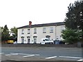
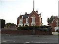
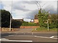
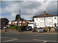
36 photos from this area
Area Information
Key information about the DY9 0QS including its size, population, and administrative classification.
- Area Type
- Postcode
- Area Size
- 4.7 hectares
- Population
- 1520
- Population Density
- 285 people/km²
House Prices in DY9 0QS
34
Properties
£247,570
Average Sold Price
£107,000
Lowest Price
£510,000
Highest Price
Showing 34 properties
| Address | Type | Beds | Baths | Last Sale Price | Last Sale Date | |
|---|---|---|---|---|---|---|
| 55 Stourbridge Road, Hagley, DY9 0QS | Terraced | 2 | 1 | £246,000 | Aug 2023 | |
| 45 Stourbridge Road, Hagley, DY9 0QS | Terraced | 3 | 2 | £425,000 | Nov 2022 | |
| 33 Stourbridge Road, Hagley, DY9 0QS | Bungalow | 3 | 3 | £370,500 | Mar 2022 | |
| 51B Stourbridge Road, Hagley, DY9 0QS | Terraced | 2 | 1 | £169,950 | Jun 2021 | |
| 23 Stourbridge Road, Hagley, DY9 0QS | Detached | 4 | 2 | £420,000 | Jan 2021 | |
| 39 Stourbridge Road, Hagley, DY9 0QS | Semi-detached | 3 | 1 | £280,000 | Dec 2020 | |
| 47 Stourbridge Road, Hagley, DY9 0QS | house | - | - | £217,000 | Mar 2020 | |
| 69 Stourbridge Road, Hagley, DY9 0QS | Terraced | 2 | 1 | £184,000 | Aug 2019 | |
| 73 Stourbridge Road, Hagley, DY9 0QS | house | 3 | - | £280,000 | Feb 2019 | |
| 51 Stourbridge Road, Hagley, DY9 0QS | house | 4 | - | £190,000 | Oct 2018 |
Page 1 of 4
Energy Efficiency in DY9 0QS
Amenities
Schools
| Rank | School | Type | Entry gender | Ages |
|---|
Explore more schools in this area
Go to Schools tabDemographics
Household Size
Family (3-5 people)
most common
Accommodation Type
Houses
most common
Tenure
86
majority
Ethnic Group
White
most common
Religion
N/A
most common
Household Composition
N/A
most common
Age
47
median
Adults (30-64 years)
most common
Household Deprivation
N/A
with no deprivation
NS-SEC
49
in Lower managerial occupations
Explore more demographic insights in this area
Go to Demographics tabPlanning
Planning Constraints
- Flood RiskPremium
- Ramsar Wetland SitesPremium
- Area of Outstanding Natural BeautyPremium
- Protected Nature ReservePremium
- Protected WoodlandPremium