Area Overview for DY9 0JE
Photos of DY9 0JE
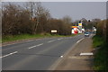
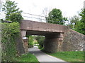
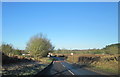
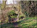
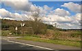


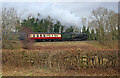
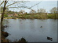
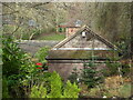
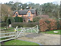
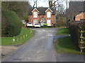
43 photos from this area
Area Information
Key information about the DY9 0JE including its size, population, and administrative classification.
- Area Type
- Postcode
- Area Size
- 4.4 hectares
- Population
- 1629
- Population Density
- 954 people/km²
House Prices in DY9 0JE
14
Properties
£387,056
Average Sold Price
£139,500
Lowest Price
£615,000
Highest Price
Showing 14 properties
| Address | Type | Beds | Baths | Last Sale Price | Last Sale Date | |
|---|---|---|---|---|---|---|
| Green Oaks, Stakenbridge Lane, Hagley, DY9 0JE | house | 5 | 3 | £615,000 | Oct 2024 | |
| Little Brake, Stakenbridge Lane, Hagley, DY9 0JE | house | - | - | £527,000 | Sep 2019 | |
| Cintra, Stakenbridge Lane, Hagley, DY9 0JE | Bungalow | - | - | £390,000 | May 2017 | |
| 3 Stakenbridge Lane, Hagley, DY9 0JE | Detached | - | - | £387,000 | Sep 2010 | |
| 2 Stakenbridge Lane, Hagley, DY9 0JE | house | - | - | £332,500 | Aug 2010 | |
| Redstone, Stakenbridge Lane, Hagley, DY9 0JE | Detached | - | - | £350,000 | Jun 2008 | |
| The Cedars, 4 Stakenbridge Lane, Hagley, DY9 0JE | house | - | - | £410,000 | Oct 2003 | |
| Hawthorne Cottage, Stakenbridge Lane, Hagley, DY9 0JE | Detached | - | - | £139,500 | Nov 1999 | |
| Morlyn, 12 Stakenbridge Lane, Hagley, DY9 0JE | Detached | - | - | £332,500 | May 1999 | |
| The Gables, Stakenbridge Lane, Hagley, DY9 0JE | Semi-detached | 3 | 2 | - | - |
Page 1 of 2
Energy Efficiency in DY9 0JE
Amenities
Schools
| Rank | School | Type | Entry gender | Ages |
|---|
Explore more schools in this area
Go to Schools tabDemographics
Household Size
Two person
most common
Accommodation Type
Houses
most common
Tenure
91
majority
Ethnic Group
White
most common
Religion
N/A
most common
Household Composition
N/A
most common
Age
47
median
Adults (30-64 years)
most common
Household Deprivation
N/A
with no deprivation
NS-SEC
53
in Lower managerial occupations
Explore more demographic insights in this area
Go to Demographics tabPlanning
Planning Constraints
- Flood RiskPremium
- Ramsar Wetland SitesPremium
- Area of Outstanding Natural BeautyPremium
- Protected Nature ReservePremium
- Protected WoodlandPremium