Area Overview for DY9 0DP
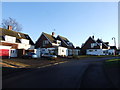
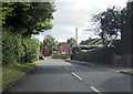
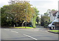
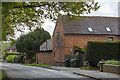
Photos of DY9 0DP
Area Information
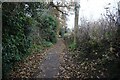
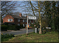
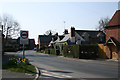
DY9 0DP sits within the village of Belbroughton in Worcestershire, a residential cluster occupying 36.2 hectares. This specific postcode area covers a population of 1,588 residents, positioned approximately six miles north of Bromsgrove and four miles south of Stourbridge. Living in DY9 0DP means residing in a historic setting where the village was first mentioned in AD 817 as part of the Bishop of Worcester's estate. The area retains significant historical character, featuring Holy Trinity Church with Norman remnants and the Grade II listed water wheel at Savage's Mill. Formerly a centre for the North Worcestershire scythe-making industry led by the Waldron and Nash families, the locality now serves a quiet residential purpose. The crime risk score of 81 out of 100 indicates a neighbourhood with below-average crime rates, offering a secure environment for families. While the area experienced severe flooding in 2008 when Belne Brook burst its banks, current flood risk assessments show a low probability of future inundation. This postcode provides access to a mix of timber-framed dwellings and conservation area features, blending industrial heritage with modern domestic life. The low population density of 187 people per square kilometre ensures a tranquil character distinct from the larger town centres nearby.
- Area Type
- Postcode
- Area Size
- 36.2 hectares
- Population
- 1588
- Population Density
- 187 people/km²
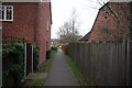
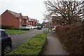
Homes in DY9 0DP represent a specific segment of the British property market defined by ownership and structure. With 77 per cent of the population being homeowners, this area operates primarily as an owner-occupied market with very few rental properties available. The accommodation type is strictly houses, limiting options for those seeking flats or apartments. This concentration of single-family homes aligns with the village's history and its designation as a conservation area, which often restricts large-scale new builds. The high ownership figure suggests that buyers here have lived in the area for significant periods, creating a stable community with established property values. Prospective buyers looking for homes in DY9 0DP are competing against a base of long-term residents rather than high volumes of year-round tenants. The lack of private rental stock means the market relies heavily on purchased transactions. When considering real estate in this postcode, potential buyers should expect a traditional market where property transfer relies on family succession or intergenerational purchase rather than the transient nature of the private rental sector common in city centres.
House Prices in DY9 0DP
Showing 5 properties
| Address | Type | Beds | Baths | Last Sale Price | Last Sale Date | |
|---|---|---|---|---|---|---|
| The Lydiate, Bradford Lane, Belbroughton, DY9 0DP | Detached | 4 | 2 | £2,700,000 | Jun 2021 | |
| Bradford House, Bradford Lane, Belbroughton, DY9 0DP | Detached | 14 | 9 | - | - | |
| Bradford Coach House, Bradford Lane, Belbroughton, DY9 0DP | house | - | - | - | - | |
| Lydiate Barn, Bradford Lane, Belbroughton, DY9 0DP | house | - | - | - | - | |
| Bradford Barn, Bradford Lane, Belbroughton, DY9 0DP | Detached | - | - | - | - |
Energy Efficiency in DY9 0DP
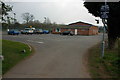
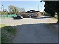
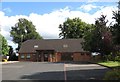
Everyday life in DY9 0DP revolves around a limited selection of local amenities within practical reach. Residents have access to five retail outlets, specifically Morrisons Daily, Co-op Hagley, and Spar, providing essential groceries and daily necessities. For wider shopping needs, the nearby Hagley Railway Station serves as a transport hub connecting the village to broader retail districts. Five railway stations operate in the immediate vicinity, including Blakedown Railway Station and Stourbridge Junction Railway Station, facilitating travel to Birmingham and Stourbridge. The absence of large leisure complexes or parks within the immediate postcode means day-to-day recreation relies heavily on these local shops and the surrounding village green. The village itself offers historical features like the 18th-century beer house and Primitive Methodist Church for cultural engagement. This transport network allows residents to reach larger towns easily while maintaining the convenience of living in a low-density environment. The combination of a village community and easy rail access defines the lifestyle balance.
Amenities
Schools
Families living near DY9 0DP have access to specific educational institutions within the local catchment area. The primary education option is Belbroughton CofE Primary School, which holds an Ofsted rating of good. This rating indicates that the school meets the expected standards for teaching and student welfare. As a Church of England institution, the school caters to families seeking religious education alongside standard academic subjects. The presence of this single listed school in the immediate vicinity emphasises the local nature of residential choices in the village. For children requiring further education, families would typically rely on the school's performance data and then explore secondary options in Bromsgrove or Kidderminster, though no secondary schools are explicitly listed for this immediate cluster. The good rating at Belbroughton CofE Primary School provides a solid foundation for early education, excluding families who specifically require alternative comprehensive or academy models in their immediate neighbourhood. Choice remains limited for young families given the single primary institution listed for the area.
| Rank | School | Type | Entry gender | Ages |
|---|
Explore more schools in this area
Go to Schools tabDemographics
The community character in DY9 0DP is defined by a high level of stability and age. The median age for residents is 47 years, with the majority of the population falling into the adult range between 30 and 64 years old. This age profile typically indicates a settled population rather than transient commuters. Home ownership stands at 77 per cent, suggesting that most families in this cluster own their properties outright or with a mortgage, rather than renting. The predominant ethnic group is White, reflecting the traditional demographic composition of the Worcestershire area. Accommodation types are exclusively houses, meaning there are no flats or apartments within this specific postcode boundary. The high ownership rate correlates with the presence of almshouses and conservative building styles like timber-framed dwellings found throughout the village. A population density of 187 people per square kilometre creates a suburban feel rather than an urban one. This demographic structure supports a local economy focused on services and leisure rather than large-scale retail or high-density development.
Household Size
Accommodation Type
Tenure
Ethnic Group
Religion
Household Composition
Age
Household Deprivation
NS-SEC
Explore more demographic insights in this area
Go to Demographics tabPlanning
Planning Constraints
- Flood RiskPremium
- Ramsar Wetland SitesPremium
- Area of Outstanding Natural BeautyPremium
- Protected Nature ReservePremium
- Protected WoodlandPremium