Area Overview for DY9 0AS
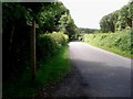
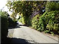
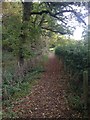
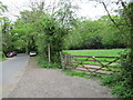
Photos of DY9 0AS
Area Information
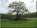
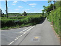
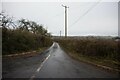
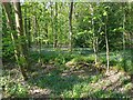
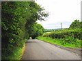
DY9 0AS, a small residential postcode in Worcestershire, lies within the village of Belbroughton, nestled between Bromsgrove, Kidderminster, and Stourbridge. With a population of 2,207 and a density of 84 people per square kilometre, it is a compact, tightly knit community. The area’s character is shaped by its history as a hub for scythe-making, with remnants of industrial heritage like the Grade II-listed water wheel at a 16th-century mill. Despite its small size, it offers a blend of rural charm and practical connectivity. Residents benefit from proximity to rail links, including Bromsgrove and Hagley stations, and a range of local amenities. The village’s population skews towards adults aged 30–64, reflecting a stable, family-oriented demographic. While the 2008 flood damaged parts of Belne Brook, current assessments show low flood risk, and the area remains free of protected natural sites or planning constraints. Living here means embracing a quiet, low-crime environment with access to essential services and a strong sense of local identity.
- Area Type
- Postcode
- Area Size
- Not available
- Population
- 2207
- Population Density
- 84 people/km²
DY9 0AS is a predominantly owner-occupied area, with 85% of homes owned by residents rather than rented. The accommodation type is exclusively houses, which is unusual for a small postcode but reflects the village’s traditional layout and historical development. This suggests a market skewed towards family homes and long-term residency rather than short-term rental properties. The limited size of the area means the housing stock is finite, so buyers should consider nearby towns like Bromsgrove or Stourbridge for additional options. The high home ownership rate indicates a stable, low-volatility market, which can be attractive to buyers seeking security. However, the scarcity of properties may mean competition for available homes, particularly for those prioritising proximity to local amenities and schools.
House Prices in DY9 0AS
No properties found in this postcode.
Energy Efficiency in DY9 0AS
DY9 0AS offers a mix of practical amenities within easy reach. The area includes five retail outlets, such as Morrisons Daily, Budgens Catshill, and Co-op Gibbs, providing essential shopping and services. These stores cater to daily needs, from groceries to household items, reducing the necessity for long trips. The rail stations at Bromsgrove, Blakedown, and Hagley add to the convenience, connecting residents to broader networks for work, leisure, or socialising. While the data does not mention parks or leisure facilities, the village’s historical sites—like the Holy Trinity Church and the listed water wheel—suggest cultural and recreational opportunities. The combination of retail access and rail connectivity ensures a lifestyle that balances self-sufficiency with the flexibility to explore nearby towns.
Amenities
Schools
Residents of DY9 0AS have access to two primary schools: Dodford First School and Fairfield First School, both rated ‘good’ by Ofsted. These institutions cater to younger children, offering a foundation for education within the village. The presence of two primary schools provides choice and convenience for families, though secondary education options are not listed in the data, suggesting parents may need to travel to nearby towns for high school. The ‘good’ Ofsted ratings indicate reliable standards of teaching and facilities, which is a key consideration for families prioritising education. The proximity of these schools to residential areas reinforces the area’s appeal to households with children, ensuring a walkable, community-focused environment for families.
| Rank | School | Type | Entry gender | Ages |
|---|
Explore more schools in this area
Go to Schools tabDemographics
The population of DY9 0AS is predominantly adults aged 30–64, with a median age of 47. This suggests a mature, established community, likely with strong family ties and long-term residency. Home ownership is high at 85%, indicating a stable housing market and a focus on long-term investment in property. The area is characterised by houses rather than flats, reflecting a preference for traditional, spacious living. The predominant ethnic group is White, though no data on diversity or deprivation is provided. With a population density of 84 people per square kilometre, the area is neither overcrowded nor sparse, offering a balance between privacy and community. The age profile and ownership figures suggest a low turnover of residents, contributing to a cohesive neighbourhood where familiarity and continuity are key aspects of daily life.
Household Size
Accommodation Type
Tenure
Ethnic Group
Religion
Household Composition
Age
Household Deprivation
NS-SEC
Explore more demographic insights in this area
Go to Demographics tabPlanning
Planning Constraints
- Flood RiskPremium
- Ramsar Wetland SitesPremium
- Area of Outstanding Natural BeautyPremium
- Protected Nature ReservePremium
- Protected WoodlandPremium