Area Overview for DY8 4XP
Photos of DY8 4XP
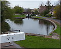
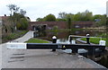
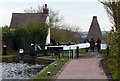
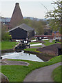
100 photos from this area
Area Information
Key information about the DY8 4XP including its size, population, and administrative classification.
- Area Type
- Postcode
- Area Size
- 1.8 hectares
- Population
- 1430
- Population Density
- 4601 people/km²
House Prices in DY8 4XP
56
Properties
£140,501
Average Sold Price
£49,000
Lowest Price
£245,000
Highest Price
Showing 56 properties
| Address | Type | Beds | Baths | Last Sale Price | Last Sale Date | |
|---|---|---|---|---|---|---|
| 83 Marine Crescent, Wordsley, DY8 4XP | Semi-detached | 3 | 1 | £232,500 | Jun 2025 | |
| 43 Marine Crescent, Wordsley, DY8 4XP | Semi-detached | 3 | 1 | £245,000 | Jan 2025 | |
| 59 Marine Crescent, Wordsley, DY8 4XP | Bungalow | 2 | - | £235,000 | Dec 2021 | |
| 82 Marine Crescent, Wordsley, DY8 4XP | Bungalow | - | - | £227,000 | Sep 2021 | |
| 75 Marine Crescent, Wordsley, DY8 4XP | Bungalow | 2 | 1 | £213,000 | Jan 2021 | |
| 41 Marine Crescent, Wordsley, DY8 4XP | Semi-detached | 3 | - | £190,500 | Sep 2019 | |
| 88 Marine Crescent, Wordsley, DY8 4XP | Bungalow | - | - | £190,000 | Nov 2017 | |
| 81 Marine Crescent, Wordsley, DY8 4XP | Semi-detached | 3 | 1 | £154,000 | Oct 2016 | |
| 60 Marine Crescent, Wordsley, DY8 4XP | house | - | - | £168,000 | May 2016 | |
| 77 Marine Crescent, Wordsley, DY8 4XP | house | 3 | - | £150,000 | Aug 2014 |
Page 1 of 6
Energy Efficiency in DY8 4XP
Amenities
Schools
| Rank | School | Type | Entry gender | Ages |
|---|
Explore more schools in this area
Go to Schools tabDemographics
Household Size
Family (3-5 people)
most common
Accommodation Type
Houses
most common
Tenure
53
majority
Ethnic Group
White
most common
Religion
N/A
most common
Household Composition
N/A
most common
Age
47
median
Adults (30-64 years)
most common
Household Deprivation
N/A
with no deprivation
NS-SEC
18
in Lower managerial occupations
Explore more demographic insights in this area
Go to Demographics tabPlanning
Planning Constraints
- Flood RiskPremium
- Ramsar Wetland SitesPremium
- Area of Outstanding Natural BeautyPremium
- Protected Nature ReservePremium
- Protected WoodlandPremium