Area Overview for DY8 4HB
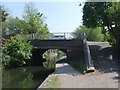
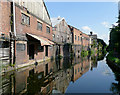
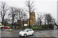
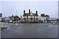
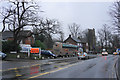
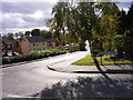
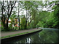
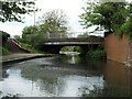
Photos of DY8 4HB


Area Information
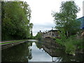
DY8 4HB is a small, tightly knit residential postcode area in England, home to around 1,595 residents. Its compact size means it feels like a close-knit community, where daily life is shaped by the surrounding landscape and local amenities. The area is predominantly composed of houses, reflecting a stable, long-term resident profile. With a median age of 47 and a strong presence of adults aged 30–64, it’s a place where families and professionals coexist. Proximity to retail hubs like Tesco Stourbridge and Sainsburys Wollaston ensures convenience, while rail links to Stourbridge Town and Lye stations offer easy access to nearby towns. The postcode’s small footprint means it’s a quiet, low-density area, yet it remains well-connected to Wolverhampton Halfpenny Green Airport and major transport routes. Living here offers a balance of privacy and practicality, with minimal environmental constraints and a low crime risk. For those seeking a settled, family-friendly environment with strong local infrastructure, DY8 4HB presents a compelling case.
- Area Type
- Postcode
- Area Size
- Not available
- Population
- 1595
- Population Density
- 4700 people/km²
The property market in DY8 4HB is characterised by high home ownership (77%) and a predominance of houses. This suggests a market skewed towards owner-occupied properties rather than rentals, which can indicate a stable, less volatile housing environment. The focus on houses, rather than flats or other formats, aligns with the area’s mature demographic and family-centric appeal. As a small postcode area, the housing stock is likely limited in volume but may offer higher demand from buyers seeking spacious, long-term residences. The lack of planning constraints such as protected woodlands or Areas of Outstanding Natural Beauty means development restrictions are minimal, potentially supporting property value retention. For buyers, this means a market where properties are likely to hold their value, though the small size of the area may limit immediate availability of comparable homes.
House Prices in DY8 4HB
No properties found in this postcode.
Energy Efficiency in DY8 4HB
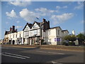
Living in DY8 4HB offers a mix of practical amenities and local convenience. Nearby retail options include Lidl Amblecote, Tesco Stourbridge, and Sainsburys Wollaston, providing essential shopping within easy reach. The area’s rail network, with stations like Stourbridge Town and Lye, ensures efficient travel to surrounding towns, while the proximity to Wolverhampton Halfpenny Green Airport caters to those needing air travel. Though the postcode is small, it is positioned to benefit from nearby leisure and commercial hubs. The retail and transport infrastructure suggests a lifestyle that prioritises accessibility without sacrificing the quiet, residential character of the area. For residents, this means a balance of daily convenience and a sense of community, with amenities tailored to meet the needs of a mature, stable population.
Amenities
Schools
| Rank | School | Type | Entry gender | Ages |
|---|
Explore more schools in this area
Go to Schools tabDemographics
The population of DY8 4HB is 1,595, with a median age of 47, indicating a mature demographic. The most common age group is adults aged 30–64, suggesting a community of established professionals and families. Home ownership is high at 77%, with houses being the predominant accommodation type. This reflects a stable, long-term resident base rather than a transient rental market. The predominant ethnic group is White, though specific diversity metrics are not detailed in the data. The age profile and ownership rates imply a low turnover of properties, which can be advantageous for buyers seeking long-term value. The absence of significant deprivation data means the area likely supports a reasonable quality of life, with housing stock tailored to older and middle-aged residents. This demographic profile shapes a community focused on stability, with a strong emphasis on family-oriented living.
Household Size
Accommodation Type
Tenure
Ethnic Group
Religion
Household Composition
Age
Household Deprivation
NS-SEC
Explore more demographic insights in this area
Go to Demographics tabPlanning
Planning Constraints
- Flood RiskPremium
- Ramsar Wetland SitesPremium
- Area of Outstanding Natural BeautyPremium
- Protected Nature ReservePremium
- Protected WoodlandPremium