Area Overview for DY8 4FP
Photos of DY8 4FP


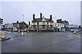


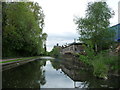

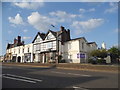
100 photos from this area
Area Information
Key information about the DY8 4FP including its size, population, and administrative classification.
- Area Type
- Postcode
- Area Size
- 5854 m²
- Population
- 2384
- Population Density
- 2871 people/km²
House Prices in DY8 4FP
40
Properties
£391,588
Average Sold Price
£332,500
Lowest Price
£436,852
Highest Price
Showing 40 properties
| Address | Type | Beds | Baths | Last Sale Price | Last Sale Date | |
|---|---|---|---|---|---|---|
| 197 Old Wharf Road, Amblecote, DY8 4FP | house | - | - | £332,500 | Dec 2024 | |
| 193 Old Wharf Road, Amblecote, DY8 4FP | house | - | - | £417,000 | Dec 2024 | |
| 195 Old Wharf Road, Amblecote, DY8 4FP | house | - | - | £436,852 | Dec 2024 | |
| 205 Old Wharf Road, Amblecote, DY8 4FP | house | - | - | £380,000 | Mar 2024 | |
| 63 Old Wharf Road, Amblecote, DY8 4FP | Detached | 4 | - | - | - | |
| 207 Old Wharf Road, Amblecote, DY8 4FP | house | - | - | - | - | |
| 201 Old Wharf Road, Amblecote, DY8 4FP | house | - | - | - | - | |
| 213 Old Wharf Road, Amblecote, DY8 4FP | house | - | - | - | - | |
| 215 Old Wharf Road, Amblecote, DY8 4FP | house | - | - | - | - | |
| Plot 171, Titan Wharf Housing Development, Old Wharf Road, Amblecote, DY8 4FP | house | - | - | - | - |
Page 1 of 4
Energy Efficiency in DY8 4FP
Amenities
Schools
| Rank | School | Type | Entry gender | Ages |
|---|
Explore more schools in this area
Go to Schools tabDemographics
Household Size
One person
most common
Accommodation Type
Houses
most common
Tenure
71
majority
Ethnic Group
White
most common
Religion
N/A
most common
Household Composition
N/A
most common
Age
47
median
Adults (30-64 years)
most common
Household Deprivation
N/A
with no deprivation
NS-SEC
34
in Lower managerial occupations
Explore more demographic insights in this area
Go to Demographics tabPlanning
Planning Constraints
- Flood RiskPremium
- Ramsar Wetland SitesPremium
- Area of Outstanding Natural BeautyPremium
- Protected Nature ReservePremium
- Protected WoodlandPremium