Area Overview for DY8 3YP
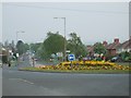
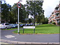
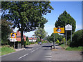
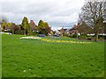
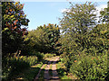
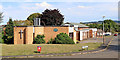
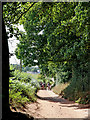
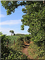
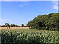
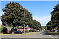
Photos of DY8 3YP


Area Information
DY8 3YP is a small, tightly knit residential area in England, home to just 1358 people. Its compact size means it feels more like a quiet village than a sprawling suburb, with a focus on private homes rather than high-density housing. The area’s character is defined by its mix of older and newer properties, many of which are family homes. Residents here are predominantly adults aged 30–64, reflecting a mature, stable community. Living in DY8 3YP offers a blend of convenience and tranquillity, with easy access to nearby towns via rail links and a well-connected digital infrastructure. The absence of major planning constraints, such as protected natural sites, means development is unlikely to disrupt the area’s peaceful atmosphere. For those seeking a low-maintenance lifestyle with a strong sense of local identity, DY8 3YP provides a compact, self-contained environment. Its proximity to Stourbridge and Wolverhampton ensures access to larger amenities without the hassle of urban congestion.
- Area Type
- Postcode
- Area Size
- Not available
- Population
- Not available
- Population Density
- Not available
DY8 3YP is primarily an owner-occupied area, with 75% of homes owned by residents rather than rented. The accommodation type is predominantly houses, which is unusual for a small postcode area but suggests a focus on family homes and long-term residency. This housing stock implies a market where property values are likely to be stable, with limited turnover. For buyers, this means a low-risk investment in a community with strong local ties. The scarcity of rental properties also means the area is not a hotspot for short-term lets or speculative buyers. However, the small size of the area means the property market is tightly bound to local demand, with limited scope for expansion. Buyers should consider the proximity to nearby towns for additional amenities, as DY8 3YP itself offers few commercial or retail options.
House Prices in DY8 3YP
No properties found in this postcode.
Energy Efficiency in DY8 3YP
Living in DY8 3YP offers a mix of practical amenities within easy reach. The area has five retail outlets, including Co-op Glebe, Co-op Broadway, and Spar, providing essentials for daily shopping. For transport, five railway stations are within practical distance, offering links to Stourbridge, Birmingham, and beyond. The presence of Wolverhampton Halfpenny Green Airport, though small, adds to the area’s accessibility. While there are no named parks or leisure facilities in the data, the absence of planning constraints like protected woodlands or AONB areas suggests open spaces may be available nearby. The compact nature of the area means amenities are concentrated, reducing the need for long commutes. This balance of convenience and quietude makes DY8 3YP appealing for those prioritising ease of access without urban chaos.
Amenities
Schools
The nearest school to DY8 3YP is Gig Mill Primary School, a primary school serving the local community. While the data lists this school twice, it appears to be the sole primary school in the immediate area. The absence of secondary schools or other educational institutions means families may need to travel to nearby towns for secondary education. This could be a consideration for parents prioritising a full range of schooling options. However, the presence of a primary school within walking distance offers convenience for younger children and may reduce reliance on transport. The school’s performance is not specified in the data, but its location suggests it is a key anchor for local families.
| Rank | School | Type | Entry gender | Ages |
|---|
Explore more schools in this area
Go to Schools tabDemographics
The population of DY8 3YP is 1358, with a median age of 47. This suggests a community skewed toward middle-aged and older adults, with the largest age group being those aged 30–64. Home ownership is high at 75%, indicating a strong presence of long-term residents and a stable housing market. The area is predominantly occupied by White residents, with no specific data on other ethnic groups. The accommodation type is largely houses, reflecting a preference for single-family homes over flats or apartments. This demographic profile aligns with a low-deprivation environment, where residents are likely to have established careers and family ties. The absence of significant diversity data means the community’s social fabric is largely homogenous, which may appeal to those seeking a familiar, cohesive neighbourhood.
Household Size
Accommodation Type
Tenure
Ethnic Group
Religion
Household Composition
Age
Household Deprivation
NS-SEC
Explore more demographic insights in this area
Go to Demographics tabPlanning
Planning Constraints
- Flood RiskPremium
- Ramsar Wetland SitesPremium
- Area of Outstanding Natural BeautyPremium
- Protected Nature ReservePremium
- Protected WoodlandPremium