Area Overview for DY8 2JW
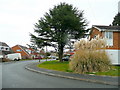
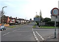
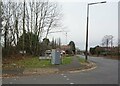
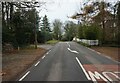
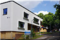
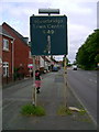
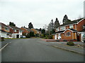
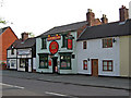
Photos of DY8 2JW


Area Information
DY8 2JW is a small, tightly knit residential postcode area in England, home to 1548 people spread across a compact footprint. With a population density of 850 people per square kilometre, this area feels more like a close-knit village than a sprawling suburb. The community here is predominantly composed of adults aged 30 to 64, reflecting a mature, stable demographic. Most residents own their homes, with 91% of properties in private ownership, suggesting a long-term presence of families and professionals. Daily life is shaped by the area’s proximity to essential services and transport links. While the postcode itself is small, its immediate surroundings offer a mix of retail and rail connectivity, ensuring residents can access shopping, dining, and commuting options without venturing far. The area’s low crime risk and absence of environmental constraints like protected woodlands or wetlands make it appealing for those seeking a balanced lifestyle. Living in DY8 2JW means enjoying a quiet, well-maintained environment with a focus on stability and practicality, ideal for those prioritising safety and convenience over urban vibrancy.
- Area Type
- Postcode
- Area Size
- Not available
- Population
- 1548
- Population Density
- 850 people/km²
DY8 2JW is overwhelmingly an owner-occupied area, with 91% of properties in private hands. This high rate of home ownership suggests a community of long-term residents who have established roots in the area. The accommodation type is predominantly houses, which is notable given the postcode’s small size. This mix of single-family homes and the absence of flats or apartments indicates a focus on traditional, spacious living. For buyers, this means the housing stock is likely to be well-maintained, with properties designed for family living. However, the limited number of rental properties suggests a restricted secondary market, which could impact buyers seeking investment opportunities. The small area’s compact nature means property values may be influenced by proximity to nearby amenities, such as retail hubs and rail stations. Buyers should consider the area’s limited size when assessing long-term growth potential.
House Prices in DY8 2JW
No properties found in this postcode.
Energy Efficiency in DY8 2JW
The lifestyle in DY8 2JW is shaped by its proximity to retail and rail amenities. Residents can access major supermarkets like Asda, Tesco, and M&S Stourbridge BP, ensuring convenience for grocery shopping and daily errands. The area’s rail network, with stations such as Stourbridge Junction and Hagley, offers straightforward commuting options to nearby towns and cities. While the postcode itself is small, the surrounding region provides a balance of urban and rural elements, though specific parks or leisure facilities are not detailed in the data. The presence of multiple retail outlets suggests a focus on practicality over expansive leisure options. For those prioritising ease of access to shopping and transport, DY8 2JW delivers a functional lifestyle without the need for lengthy travel.
Amenities
Schools
Residents of DY8 2JW have access to a range of schools, including two primary schools with Ofsted ratings of ‘good’ and one independent school also rated ‘good’. Oldswinford C of E Primary School and Elmfield Rudolf Steiner School Limited offer alternative educational approaches, while St Joseph’s RC Primary School provides a traditional Catholic education. The presence of both state and independent options gives families flexibility in choosing a school that aligns with their values and needs. The ‘good’ Ofsted ratings indicate that these schools meet or exceed national standards in teaching quality and student outcomes. For families prioritising education, the mix of school types ensures a choice between public and private schooling without requiring a long commute. This diversity in educational provision is a key advantage for parents seeking to balance academic standards with their child’s learning environment.
| Rank | School | Type | Entry gender | Ages |
|---|
Explore more schools in this area
Go to Schools tabDemographics
The population of DY8 2JW is 1548, with a median age of 47, indicating a mature community where most residents are in their prime working years or beyond. The most common age range is 30 to 64, suggesting a mix of established families and professionals. Home ownership is exceptionally high at 91%, with the majority of properties being houses rather than flats. This reflects a demographic that values long-term residency and property investment. The predominant ethnic group is White, aligning with broader regional trends. The absence of specific data on deprivation or diversity metrics means the area’s social composition remains largely homogeneous. For those considering living here, the high home ownership rate and age profile suggest a stable, low-turnover community. The lack of rental properties also implies limited short-term letting activity, which could be a consideration for buyers seeking flexibility.
Household Size
Accommodation Type
Tenure
Ethnic Group
Religion
Household Composition
Age
Household Deprivation
NS-SEC
Explore more demographic insights in this area
Go to Demographics tabPlanning
Planning Constraints
- Flood RiskPremium
- Ramsar Wetland SitesPremium
- Area of Outstanding Natural BeautyPremium
- Protected Nature ReservePremium
- Protected WoodlandPremium