Area Overview for DY8 1YT
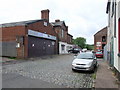
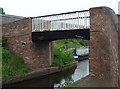
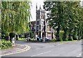
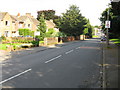
Photos of DY8 1YT


Area Information
DY8 1YT is a small, tightly knit residential postcode area in England, home to 1,457 people. Its compact size means it is likely a cluster of homes rather than a sprawling suburb, offering a quiet, community-focused environment. The area’s demographics suggest a mature population, with a median age of 47 and the majority of residents falling within the 30-64 age range. This indicates a stable, established community with a focus on long-term residency. Daily life here is likely characterised by a mix of local amenities, including nearby shops, railway stations, and schools. The area’s low crime risk and absence of environmental constraints such as protected woodlands or wetlands make it an attractive option for those seeking a peaceful, low-maintenance lifestyle. With 72% of homes owned by residents, DY8 1YT leans towards being a place where people settle rather than a transient rental market. Its proximity to retail hubs like Tesco Stourbridge and multiple railway stations suggests easy access to nearby towns and services, balancing seclusion with connectivity. For buyers, this area offers a snapshot of traditional English suburbia, with a focus on practicality and safety.
- Area Type
- Postcode
- Area Size
- Not available
- Population
- 1457
- Population Density
- 5812 people/km²
DY8 1YT is predominantly a home-owning area, with 72% of properties owned by residents rather than rented. This suggests a community of long-term residents, which can indicate stability and lower turnover. The accommodation type is primarily houses, which is typical for smaller, rural or semi-rural postcode areas. This contrasts with urban centres where flats or apartments are more common. For buyers, this means the housing stock is likely characterised by family homes, possibly with gardens, rather than smaller units. The small population and compact size of the area mean the property market is limited in scale, with fewer options available compared to larger towns. However, the proximity to nearby towns like Stourbridge, served by multiple railway stations, may offer additional opportunities for those seeking a broader range of properties. Buyers should consider the area’s limited size when evaluating its immediate surroundings for potential expansion or alternative housing options.
House Prices in DY8 1YT
No properties found in this postcode.
Energy Efficiency in DY8 1YT
Residents of DY8 1YT have access to a range of nearby amenities, including five retail outlets such as Tesco Stourbridge, Waitrose Stourbridge, and Iceland Stourbridge. These shops provide essential services for daily living, from groceries to household supplies. The proximity to multiple railway stations, including Stourbridge Junction and Lye, enhances connectivity to larger towns and cities, offering opportunities for leisure, work, or shopping beyond the immediate area. While the data does not specify parks or leisure facilities, the area’s low environmental risk and absence of planning constraints suggest open spaces may be available for recreation. The combination of retail options and transport links creates a lifestyle that balances local convenience with regional accessibility, ideal for those seeking a self-contained yet connected community.
Amenities
Schools
The nearest school to DY8 1YT is The Longlands School, a primary institution. While no Ofsted rating is provided, the presence of a primary school suggests the area is well-served for families with young children. The absence of secondary schools in the data means residents may need to travel to nearby towns for secondary education. The single primary school indicates a focus on local schooling, which can be convenient for families seeking to avoid long commutes. For those prioritising proximity to educational institutions, the availability of a primary school within practical reach is a key consideration. However, the lack of data on secondary schools or their quality means further research would be necessary for families requiring comprehensive schooling options.
| Rank | School | Type | Entry gender | Ages |
|---|
Explore more schools in this area
Go to Schools tabDemographics
The population of DY8 1YT is 1,457, with a median age of 47, reflecting a mature demographic. The majority of residents are adults aged 30-64, indicating a community that is largely settled and stable. Home ownership is high at 72%, suggesting a strong presence of long-term residents rather than renters. The predominant accommodation type is houses, which aligns with the area’s character as a residential cluster rather than a high-density development. The predominant ethnic group is White, though the data does not specify further diversity metrics. This demographic profile implies a community with established routines, likely centred on local amenities and family life. The absence of detailed deprivation data means quality of life can be inferred from the area’s safety and infrastructure, such as the low crime risk and proximity to schools and transport. For families, the mix of age groups and home ownership suggests a balance between generational stability and potential for new residents.
Household Size
Accommodation Type
Tenure
Ethnic Group
Religion
Household Composition
Age
Household Deprivation
NS-SEC
Explore more demographic insights in this area
Go to Demographics tabPlanning
Planning Constraints
- Flood RiskPremium
- Ramsar Wetland SitesPremium
- Area of Outstanding Natural BeautyPremium
- Protected Nature ReservePremium
- Protected WoodlandPremium