Area Overview for DY8 1LU
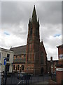
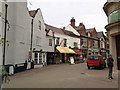
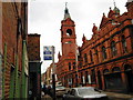
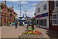
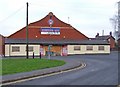
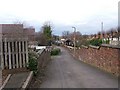
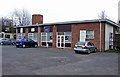
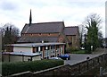
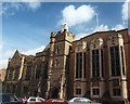
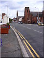
Photos of DY8 1LU
Area Information
Living in DY8 1LU means inhabiting a compact, residential cluster in England with a population of 2018 people spread over 1088 square metres. This makes it one of the most densely populated areas in the country, with 1.85 million people per square kilometre. Despite its small size, the area offers a mix of practical amenities and connectivity. Residents benefit from proximity to five railway stations, including Stourbridge Town and Lye, which provide access to regional transport networks. The area is served by retail options like Aldi, Iceland, and Waitrose, supporting daily errands. Schools such as Redhill School and Specialist Language College cater to primary education, while Redhill School, an academy with a good Ofsted rating, offers secondary-level learning. The community is predominantly composed of adults aged 30–64, with a median age of 47, suggesting a mature, established population. While the area’s high density may feel cramped, its accessibility to transport and services makes it appealing for those prioritising convenience over space.
- Area Type
- Postcode
- Area Size
- 1088 m²
- Population
- 2018
- Population Density
- 3228 people/km²
The property market in DY8 1LU is characterised by a 54% home ownership rate, with houses being the primary accommodation type. This suggests a focus on owner-occupied properties rather than a rental-heavy market, though the exact proportion of rental properties is not specified. Given the area’s small size—just 1088 square metres—it is likely that the housing stock is limited, with properties concentrated in a compact cluster. The predominance of houses over flats or apartments may appeal to buyers seeking traditional family homes, though the high population density could mean limited space per household. For buyers, the area’s proximity to schools, rail stations, and retail amenities may offset its small size. However, the lack of detailed data on property prices, availability, or recent trends means potential buyers should consider the area’s constraints alongside its conveniences.
House Prices in DY8 1LU
Showing 1 properties
| Address | Type | Beds | Baths | Last Sale Price | Last Sale Date | |
|---|---|---|---|---|---|---|
| 15-17 Church Street, Stourbridge, DY8 1LU | Office | - | - | - | - |
Energy Efficiency in DY8 1LU
Residents of DY8 1LU have access to practical amenities within walking or short driving distance. The area is served by five railway stations, including Stourbridge Town and Lye, which connect to broader transport networks. Retail options include Aldi, Iceland, and Waitrose, providing grocery and household shopping conveniences. While the data does not mention parks, leisure facilities, or dining venues, the proximity to rail stations and retail outlets suggests a focus on functional living over leisure. The compact nature of the area means residents are likely within close proximity to each other, fostering a sense of community. However, the absence of specific data on parks or recreational spaces means the area’s appeal for outdoor activities cannot be assessed. For those prioritising accessibility to transport and shopping, DY8 1LU offers a practical, if limited, lifestyle.
Amenities
Schools
Residents of DY8 1LU have access to two named schools: Redhill School and Specialist Language College, a primary school, and Redhill School, an academy with a good Ofsted rating. The presence of both a primary school and a secondary-level academy offers families a range of educational options. The good Ofsted rating for the academy suggests a school that meets or exceeds national standards in teaching and student outcomes. However, the absence of additional schools, such as nurseries or sixth-form colleges, means families may need to travel for specialist education or extracurricular activities. The proximity of these schools to the area—though not quantified—suggests they are within practical reach for residents. For families prioritising education, the combination of primary and secondary options provides some flexibility, though the limited number of schools may be a consideration for those seeking diverse or specialist provision.
| Rank | School | Type | Entry gender | Ages |
|---|
Explore more schools in this area
Go to Schools tabDemographics
The community in DY8 1LU is predominantly composed of adults aged 30–64, with a median age of 47. This suggests a mature, settled population, likely with long-term ties to the area. Home ownership stands at 54%, indicating a balance between owner-occupied properties and rental stock, though the exact proportion of renters is not specified. The accommodation type is primarily houses, which contrasts with areas dominated by flats or apartments. The predominant ethnic group is White, though no data is provided on the representation of other ethnicities. The high population density—1.85 million people per square kilometre—raises questions about living conditions, though the area’s small size means residents are likely within close proximity to each other. This density may influence local dynamics, from shared community spaces to potential strain on infrastructure. The absence of specific deprivation data means quality of life factors like access to services or green spaces cannot be assessed from this dataset alone.
Household Size
Accommodation Type
Tenure
Ethnic Group
Religion
Household Composition
Age
Household Deprivation
NS-SEC
Explore more demographic insights in this area
Go to Demographics tabPlanning
Planning Constraints
- Flood RiskPremium
- Ramsar Wetland SitesPremium
- Area of Outstanding Natural BeautyPremium
- Protected Nature ReservePremium
- Protected WoodlandPremium