Area Overview for DY7 6SZ
Photos of DY7 6SZ


Area Information
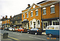
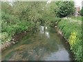
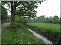
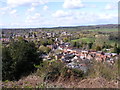
DY7 6SZ is a small, tightly knit residential postcode in England, home to just 1,164 people. This area reflects a quiet, settled community where the majority of residents are adults aged 30–64, with a median age of 47. The cluster of homes here suggests a focus on family living, with houses forming the predominant type of accommodation. Daily life in DY7 6SZ is shaped by its proximity to essential services, including five retail outlets like Co-op Kinver and Spar, and five railway stations such as Stourbridge Town and Blakedown. The area’s modest size means it is likely surrounded by open countryside or smaller villages, offering a balance between convenience and tranquillity. With a population under 1,200, the community feels close-knit, and the low crime risk score of 70 indicates a safe environment. Residents here benefit from practical transport links, including a nearby railway network and Wolverhampton Halfpenny Green Airport, while digital connectivity scores suggest reliable broadband and mobile coverage. For those seeking a peaceful yet accessible location, DY7 6SZ offers a snapshot of traditional English rural living with modern amenities within reach.
- Area Type
- Postcode
- Area Size
- Not available
- Population
- 1164
- Population Density
- 1425 people/km²
The property market in DY7 6SZ is characterised by a strong emphasis on owner-occupation, with 66% of residents owning their homes. This suggests a stable, long-term demographic, with properties predominantly being houses rather than flats or apartments. The focus on single-family homes indicates a market tailored to families or individuals seeking spacious, private living. Given the area’s small size, the housing stock is likely limited, with limited scope for new developments. Buyers considering DY7 6SZ should expect a market where properties are held by long-term owners, potentially offering good value for those seeking a quiet, low-maintenance lifestyle. The proximity to railway stations and retail amenities may enhance the area’s appeal, though the small population means the immediate surroundings are likely to be rural or semi-rural. For those prioritising home ownership in a safe, family-friendly environment, DY7 6SZ presents a niche opportunity within a broader regional property landscape.
House Prices in DY7 6SZ
No properties found in this postcode.
Energy Efficiency in DY7 6SZ
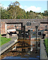
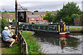
Living in DY7 6SZ offers access to a range of practical amenities within easy reach. Residents can shop at Co-op Kinver, Tesco Cookley, and Spar, providing everyday essentials without the need to travel far. The five nearby railway stations, including Stourbridge Junction, offer direct links to larger towns and cities, enhancing mobility for commuting or socialising. The area’s proximity to Wolverhampton Halfpenny Green Airport may also appeal to those with travel interests, though it is not a major hub. The character of the area is defined by its small-scale retail and transport networks, creating a self-contained yet connected lifestyle. While the absence of detailed information on parks or leisure facilities means the natural environment remains unexplored here, the low crime risk and quiet setting suggest a peaceful backdrop to daily life. For those valuing convenience without urban sprawl, DY7 6SZ’s amenities provide a functional, community-focused experience.
Amenities
Schools
| Rank | School | Type | Entry gender | Ages |
|---|
Explore more schools in this area
Go to Schools tabDemographics
The demographic profile of DY7 6SZ is defined by its adult population, with 66% of residents owning their homes. The median age of 47 indicates a community of middle-aged individuals, many of whom fall within the 30–64 age range. This suggests a stable, long-term resident base, likely centred around family households. The predominant ethnic group is White, reflecting the area’s traditional demographic makeup. Home ownership is strong, with 66% of properties occupied by their owners, pointing to a community that values stability and investment in property. The focus on houses rather than flats or apartments aligns with this trend, offering larger living spaces suited to families. While no specific data on deprivation is provided, the low crime risk score of 70 implies a relatively secure environment, which may contribute to a higher quality of life. The absence of significant diversity data does not detract from the area’s appeal but highlights its homogeneous character, which may resonate with those seeking a familiar, cohesive community.
Household Size
Accommodation Type
Tenure
Ethnic Group
Religion
Household Composition
Age
Household Deprivation
NS-SEC
Explore more demographic insights in this area
Go to Demographics tabPlanning
Planning Constraints
- Flood RiskPremium
- Ramsar Wetland SitesPremium
- Area of Outstanding Natural BeautyPremium
- Protected Nature ReservePremium
- Protected WoodlandPremium