Area Overview for DY7 6RH
Photos of DY7 6RH


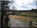
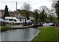


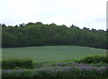

105 photos from this area
Area Information
Key information about the DY7 6RH including its size, population, and administrative classification.
- Area Type
- Postcode
- Area Size
- 3964 m²
- Population
- 1766
- Population Density
- 122 people/km²
House Prices in DY7 6RH
35
Properties
£144,259
Average Sold Price
£100,000
Lowest Price
£199,995
Highest Price
Showing 35 properties
| Address | Type | Beds | Baths | Last Sale Price | Last Sale Date | |
|---|---|---|---|---|---|---|
| 15, Stewponey Court, The Stewponey, Stourton, DY7 6RH | Flat | 2 | 1 | £145,000 | Oct 2025 | |
| 5, Stewponey Court, The Stewponey, Stourton, DY7 6RH | Flat | 2 | 1 | £100,000 | Feb 2025 | |
| 21, Stewponey Court, The Stewponey, Stourton, DY7 6RH | Flat | - | - | £145,000 | Dec 2024 | |
| 31, Stewponey Court, The Stewponey, Stourton, DY7 6RH | Flat | - | - | £195,000 | Jul 2024 | |
| 27, Stewponey Court, The Stewponey, Stourton, DY7 6RH | Flat | 2 | 2 | £142,500 | Jan 2024 | |
| 33, Stewponey Court, The Stewponey, Stourton, DY7 6RH | Flat | - | - | £161,000 | May 2023 | |
| 25, Stewponey Court, The Stewponey, Stourton, DY7 6RH | Flat | 2 | 1 | £135,000 | May 2022 | |
| 22, Stewponey Court, The Stewponey, Stourton, DY7 6RH | Flat | 2 | 2 | £137,000 | Feb 2022 | |
| 24, Stewponey Court, The Stewponey, Stourton, DY7 6RH | Flat | - | - | £133,500 | Nov 2020 | |
| 17, Stewponey Court, The Stewponey, Stourton, DY7 6RH | Flat | - | - | £130,000 | Sep 2019 |
Page 1 of 4
Energy Efficiency in DY7 6RH
Amenities
Schools
| Rank | School | Type | Entry gender | Ages |
|---|
Explore more schools in this area
Go to Schools tabDemographics
Household Size
Two person
most common
Accommodation Type
Houses
most common
Tenure
90
majority
Ethnic Group
White
most common
Religion
N/A
most common
Household Composition
N/A
most common
Age
47
median
Adults (30-64 years)
most common
Household Deprivation
N/A
with no deprivation
NS-SEC
50
in Lower managerial occupations
Explore more demographic insights in this area
Go to Demographics tabPlanning
Planning Constraints
- Flood RiskPremium
- Ramsar Wetland SitesPremium
- Area of Outstanding Natural BeautyPremium
- Protected Nature ReservePremium
- Protected WoodlandPremium