Area Overview for DY7 5BD
Photos of DY7 5BD
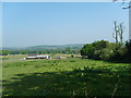
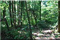
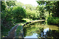
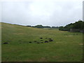
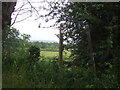
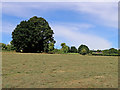
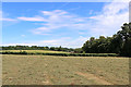
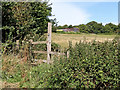
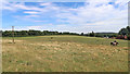
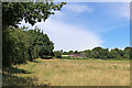
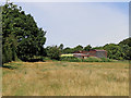
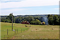
34 photos from this area
Area Information
Key information about the DY7 5BD including its size, population, and administrative classification.
- Area Type
- Postcode
- Area Size
- 62.4 hectares
- Population
- 1458
- Population Density
- 94 people/km²
House Prices in DY7 5BD
15
Properties
£403,750
Average Sold Price
£180,000
Lowest Price
£495,000
Highest Price
Showing 15 properties
| Address | Type | Beds | Baths | Last Sale Price | Last Sale Date | |
|---|---|---|---|---|---|---|
| 29 Greensforge Lane, Stourton, DY7 5BD | Semi-detached | 6 | 4 | £450,000 | Nov 2023 | |
| 34 Greensforge Lane, Stourton, DY7 5BD | house | - | - | £325,000 | Apr 2019 | |
| 33 Greensforge Lane, Stourton, DY7 5BD | Semi-detached | 4 | - | £480,000 | Dec 2015 | |
| Little Orchard, Greensforge Lane, Stourton, DY7 5BD | house | 4 | - | £475,000 | Jul 2013 | |
| Top Barn, Greensforge Lane, Stourton, DY7 5BD | Semi-detached | - | - | £495,000 | Jul 2007 | |
| Rose Cottage, Greensforge Lane, Stourton, DY7 5BD | Detached | - | - | £385,000 | Sep 2005 | |
| Owls Nest Cottage, Greensforge Lane, Stourton, DY7 5BD | Detached | - | - | £440,000 | Jun 2003 | |
| 28 Greensforge Lane, Stourton, DY7 5BD | Semi-detached | - | - | £180,000 | Jan 2000 | |
| Stourton Cottage, Greensforge Lane, Stourton, DY7 5BD | Detached | 6 | 4 | - | - | |
| 33A Greensforge Lane, Stourton, DY7 5BD | Detached | - | - | - | - |
Page 1 of 2
Energy Efficiency in DY7 5BD
Amenities
Schools
| Rank | School | Type | Entry gender | Ages |
|---|
Explore more schools in this area
Go to Schools tabDemographics
Household Size
Two person
most common
Accommodation Type
Houses
most common
Tenure
87
majority
Ethnic Group
White
most common
Religion
N/A
most common
Household Composition
N/A
most common
Age
47
median
Adults (30-64 years)
most common
Household Deprivation
N/A
with no deprivation
NS-SEC
45
in Lower managerial occupations
Explore more demographic insights in this area
Go to Demographics tabPlanning
Planning Constraints
- Flood RiskPremium
- Ramsar Wetland SitesPremium
- Area of Outstanding Natural BeautyPremium
- Protected Nature ReservePremium
- Protected WoodlandPremium