Area Overview for DY6 8QH
Photos of DY6 8QH
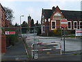
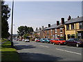
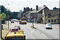
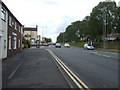
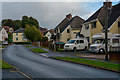
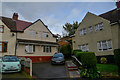
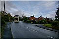
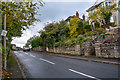
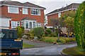
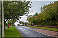
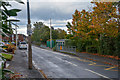
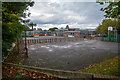
31 photos from this area
Area Information
Key information about the DY6 8QH including its size, population, and administrative classification.
- Area Type
- Postcode
- Area Size
- 8658 m²
- Population
- 1231
- Population Density
- 3397 people/km²
House Prices in DY6 8QH
22
Properties
£149,345
Average Sold Price
£58,000
Lowest Price
£248,000
Highest Price
Showing 22 properties
| Address | Type | Beds | Baths | Last Sale Price | Last Sale Date | |
|---|---|---|---|---|---|---|
| 14 Rangeways Road, Kingswinford, DY6 8QH | house | 3 | 1 | £248,000 | Mar 2023 | |
| 28 Rangeways Road, Kingswinford, DY6 8QH | house | - | - | £188,000 | Mar 2018 | |
| 26 Rangeways Road, Kingswinford, DY6 8QH | house | - | - | £183,000 | Sep 2017 | |
| 17 Rangeways Road, Kingswinford, DY6 8QH | Detached | 3 | - | £180,000 | Sep 2015 | |
| 22 Rangeways Road, Kingswinford, DY6 8QH | Semi-detached | 3 | 1 | £143,000 | Apr 2015 | |
| 19 Rangeways Road, Kingswinford, DY6 8QH | Detached | 3 | - | £150,000 | Nov 2013 | |
| 25 Rangeways Road, Kingswinford, DY6 8QH | Bungalow | - | - | £155,000 | Dec 2011 | |
| 31 Rangeways Road, Kingswinford, DY6 8QH | Bungalow | - | - | £101,450 | Dec 2001 | |
| 21 Rangeways Road, Kingswinford, DY6 8QH | Semi-detached | - | - | £87,000 | Nov 2000 | |
| 30 Rangeways Road, Kingswinford, DY6 8QH | Detached | - | - | £58,000 | Feb 1997 |
Page 1 of 3
Energy Efficiency in DY6 8QH
Amenities
Schools
| Rank | School | Type | Entry gender | Ages |
|---|
Explore more schools in this area
Go to Schools tabDemographics
Household Size
Two person
most common
Accommodation Type
Houses
most common
Tenure
86
majority
Ethnic Group
White
most common
Religion
N/A
most common
Household Composition
N/A
most common
Age
47
median
Adults (30-64 years)
most common
Household Deprivation
N/A
with no deprivation
NS-SEC
29
in Lower managerial occupations
Explore more demographic insights in this area
Go to Demographics tabPlanning
Planning Constraints
- Flood RiskPremium
- Ramsar Wetland SitesPremium
- Area of Outstanding Natural BeautyPremium
- Protected Nature ReservePremium
- Protected WoodlandPremium