Area Overview for DY6 7RU
Photos of DY6 7RU
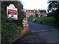

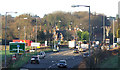
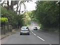
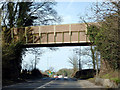
74 photos from this area
Area Information
Key information about the DY6 7RU including its size, population, and administrative classification.
- Area Type
- Postcode
- Area Size
- 5850 m²
- Population
- 1495
- Population Density
- 1217 people/km²
House Prices in DY6 7RU
21
Properties
£98,623
Average Sold Price
£30,000
Lowest Price
£154,950
Highest Price
Showing 21 properties
| Address | Type | Beds | Baths | Last Sale Price | Last Sale Date | |
|---|---|---|---|---|---|---|
| 27 Monteagle Drive, Kingswinford, DY6 7RU | Flat | 1 | 1 | £96,000 | Feb 2022 | |
| 41 Monteagle Drive, Kingswinford, DY6 7RU | house | 3 | - | £140,500 | Sep 2012 | |
| 29 Monteagle Drive, Kingswinford, DY6 7RU | Flat | 1 | 1 | £91,500 | Feb 2011 | |
| 31 Monteagle Drive, Kingswinford, DY6 7RU | Flat | - | - | £94,500 | Dec 2009 | |
| 7 Monteagle Drive, Kingswinford, DY6 7RU | Terraced | - | - | £154,950 | Jul 2007 | |
| 39 Monteagle Drive, Kingswinford, DY6 7RU | Terraced | - | - | £137,950 | Apr 2006 | |
| 33 Monteagle Drive, Kingswinford, DY6 7RU | Maisonette | - | - | £86,950 | May 2005 | |
| 25 Monteagle Drive, Kingswinford, DY6 7RU | Terraced | - | - | £136,500 | Feb 2005 | |
| 11 Monteagle Drive, Kingswinford, DY6 7RU | Flat | 3 | 1 | £53,000 | Nov 2002 | |
| 35 Monteagle Drive, Kingswinford, DY6 7RU | Terraced | 3 | 1 | £63,000 | Sep 1999 |
Page 1 of 3
Energy Efficiency in DY6 7RU
Amenities
Schools
| Rank | School | Type | Entry gender | Ages |
|---|
Explore more schools in this area
Go to Schools tabDemographics
Household Size
Two person
most common
Accommodation Type
Houses
most common
Tenure
77
majority
Ethnic Group
White
most common
Religion
N/A
most common
Household Composition
N/A
most common
Age
47
median
Adults (30-64 years)
most common
Household Deprivation
N/A
with no deprivation
NS-SEC
34
in Lower managerial occupations
Explore more demographic insights in this area
Go to Demographics tabPlanning
Planning Constraints
- Flood RiskPremium
- Ramsar Wetland SitesPremium
- Area of Outstanding Natural BeautyPremium
- Protected Nature ReservePremium
- Protected WoodlandPremium