Area Overview for DY5 3ET
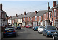
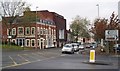
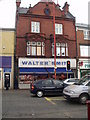
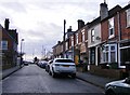
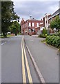
Photos of DY5 3ET

Area Information
Living in DY5 3ET means inhabiting a compact, densely populated residential cluster in England’s West Midlands. With a population of 2150 spread across 358 square metres, this area is characterised by its high population density of over 6 million people per square kilometre. The community is predominantly composed of adults aged 30–64, reflecting a mature demographic profile. Daily life here is shaped by proximity to practical amenities and transport links. Residents benefit from nearby rail stations, including Lye and Stourbridge Town, which connect to broader regional networks. The area’s compact size means essential services are within walking or cycling distance, though the high density may contribute to a sense of closeness rather than isolation. While the postcode lacks natural constraints like protected woodlands or AONBs, its small footprint ensures a focused, localised environment. For buyers, DY5 3ET offers a mix of housing stock, though its limited size means the market is tightly defined. The area’s appeal lies in its accessibility and the balance between residential living and nearby urban connectivity.
- Area Type
- Postcode
- Area Size
- 358 m²
- Population
- 2150
- Population Density
- 3411 people/km²
The property market in DY5 3ET is defined by its low home ownership rate—just 45% of residents own their homes. This suggests a rental market that is more prominent than owner-occupation, which may affect the dynamics for buyers. The area is composed primarily of houses rather than flats, indicating a focus on traditional family homes. Given the small size of the postcode and its high population density, the housing stock is likely limited, with properties concentrated in a compact area. Buyers should consider that the market may be competitive, with fewer options available compared to larger regions. The predominance of houses could appeal to those seeking more space, but the small footprint of DY5 3ET means the immediate surroundings are critical for additional property choices. For those prioritising ownership, the lower home ownership rate might indicate opportunities, though the area’s size could limit availability.
House Prices in DY5 3ET
No properties found in this postcode.
Energy Efficiency in DY5 3ET
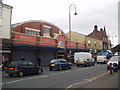
Residents of DY5 3ET have access to a range of nearby amenities, including retail outlets such as Asda Brierley, Iceland Brierley, and Farmfoods Brierley. These shops provide everyday essentials, making the area convenient for grocery shopping and daily errands. The proximity to rail stations like Lye and Stourbridge Town, along with metro stops at Dartmouth Street and Lodge Road, ensures easy access to public transport for commuting or leisure. While the data does not specify parks or leisure facilities, the presence of multiple retail and transport options suggests a practical, community-focused lifestyle. The compact nature of the area means amenities are within walking or cycling distance, promoting a sense of convenience. For those prioritising accessibility, the combination of retail, transport, and connectivity makes DY5 3ET a functional base for daily life.
Amenities
Schools
The nearest school to DY5 3ET is Brockmoor Primary School, which holds a ‘good’ Ofsted rating. This school serves the local community with primary education, though no secondary schools are listed in the data. Families with young children may find the primary school a reliable option, but those requiring secondary education would need to look beyond the immediate area. The presence of a ‘good’ rated primary school suggests a baseline standard of education, though the absence of secondary schools could be a consideration for households planning long-term. The school’s proximity to the postcode means it is likely within walking distance for many residents, enhancing its accessibility. However, without additional educational institutions nearby, parents may need to factor in commuting times or alternative schooling options.
| Rank | School | Type | Entry gender | Ages |
|---|
Explore more schools in this area
Go to Schools tabDemographics
DY5 3ET’s population skews towards adults aged 30–64, with a median age of 47. This suggests a community of established professionals and families, rather than a younger or elderly demographic. Home ownership here is relatively low at 45%, indicating a rental market that dominates. The area is composed largely of houses, not flats, which may appeal to those seeking more space. The predominant ethnic group is White, though no specific diversity metrics are provided. The high population density—over 6 million people per square kilometre—suggests a tightly packed environment, which may influence the character of local interactions and the availability of private outdoor space. While the data does not specify deprivation levels, the combination of high density and lower home ownership could imply a mix of socioeconomic profiles. For prospective buyers, understanding the age and household composition is key to assessing whether the area aligns with their lifestyle needs.
Household Size
Accommodation Type
Tenure
Ethnic Group
Religion
Household Composition
Age
Household Deprivation
NS-SEC
Explore more demographic insights in this area
Go to Demographics tabPlanning
Planning Constraints
- Flood RiskPremium
- Ramsar Wetland SitesPremium
- Area of Outstanding Natural BeautyPremium
- Protected Nature ReservePremium
- Protected WoodlandPremium