Area Overview for DY5 2QB
Photos of DY5 2QB
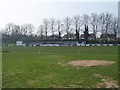
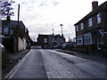
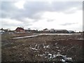
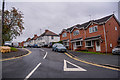
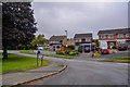
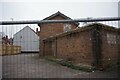
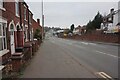
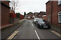
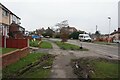
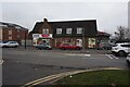
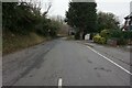
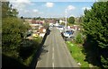
48 photos from this area
Area Information
Key information about the DY5 2QB including its size, population, and administrative classification.
- Area Type
- Postcode
- Area Size
- 4446 m²
- Population
- 1442
- Population Density
- 4598 people/km²
House Prices in DY5 2QB
14
Properties
£156,063
Average Sold Price
£102,000
Lowest Price
£205,000
Highest Price
Showing 14 properties
| Address | Type | Beds | Baths | Last Sale Price | Last Sale Date | |
|---|---|---|---|---|---|---|
| 35 Bittern Walk, Brierley Hill, DY5 2QB | Semi-detached | 3 | 1 | £115,000 | Mar 2025 | |
| 39 Bittern Walk, Brierley Hill, DY5 2QB | Semi-detached | 3 | 1 | £205,000 | Aug 2024 | |
| 47 Bittern Walk, Brierley Hill, DY5 2QB | Semi-detached | 3 | 1 | £190,000 | Mar 2023 | |
| 59 Bittern Walk, Brierley Hill, DY5 2QB | Semi-detached | 3 | 1 | £192,500 | Jul 2022 | |
| 45 Bittern Walk, Brierley Hill, DY5 2QB | Semi-detached | 3 | 1 | £158,000 | Jan 2020 | |
| 57 Bittern Walk, Brierley Hill, DY5 2QB | Semi-detached | 3 | 1 | £142,500 | Oct 2018 | |
| 55 Bittern Walk, Brierley Hill, DY5 2QB | Semi-detached | 3 | 1 | £143,500 | Dec 2017 | |
| 41 Bittern Walk, Brierley Hill, DY5 2QB | house | 3 | - | £102,000 | Sep 2004 | |
| 61 Bittern Walk, Brierley Hill, DY5 2QB | Land | - | - | - | - | |
| 49 Bittern Walk, Brierley Hill, DY5 2QB | Semi-detached | - | - | - | - |
Page 1 of 2
Energy Efficiency in DY5 2QB
Amenities
Schools
| Rank | School | Type | Entry gender | Ages |
|---|
Explore more schools in this area
Go to Schools tabDemographics
Household Size
Two person
most common
Accommodation Type
Houses
most common
Tenure
91
majority
Ethnic Group
White
most common
Religion
N/A
most common
Household Composition
N/A
most common
Age
47
median
Adults (30-64 years)
most common
Household Deprivation
N/A
with no deprivation
NS-SEC
35
in Lower managerial occupations
Explore more demographic insights in this area
Go to Demographics tabPlanning
Planning Constraints
- Flood RiskPremium
- Ramsar Wetland SitesPremium
- Area of Outstanding Natural BeautyPremium
- Protected Nature ReservePremium
- Protected WoodlandPremium