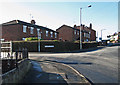
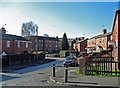
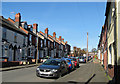
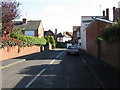
Area Overview for DY5 1AE
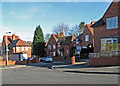
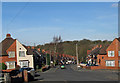
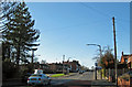
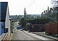
Photos of DY5 1AE
Area Information
DY5 1AE is a compact residential cluster in England, covering just 4.3 hectares. Despite its small size, it is densely populated, with 1,582 residents packed into 37,151 people per square kilometre — a figure that underscores the area’s tight-knit, urban character. This is a place where daily life unfolds within close proximity to amenities, with residents likely to know their neighbours and share a sense of community. The area is defined by its mix of homes and practical infrastructure, catering to a demographic predominantly aged 30–64, with a median age of 47. While it lacks the sprawling green spaces of rural areas, its proximity to rail and metro stations, alongside local retail, ensures convenience for commuters and families alike. Living here means navigating a high-density environment where space is limited but accessibility is strong. The area’s small footprint means it is best suited for those prioritising connectivity over open land, with a focus on practical living over expansive horizons.
- Area Type
- Postcode
- Area Size
- 4.3 hectares
- Population
- 1582
- Population Density
- 4347 people/km²
The property market in DY5 1AE is characterised by a 54% home ownership rate, with houses forming the predominant accommodation type. This suggests a mix of owner-occupied and rental properties, though the small area size limits the housing stock’s diversity. The compact nature of the postcode means properties are likely to be smaller, given the high population density. For buyers, this area is not ideal for those seeking large homes or open spaces, but it offers affordability and proximity to essential services. The high density may also mean limited scope for property expansion or redevelopment, making it a niche market for those prioritising location over size. Given the prevalence of houses, the area is unlikely to attract investors seeking high-yield rental properties, instead appealing to owner-occupiers looking for convenience. Buyers should consider the area’s constraints and focus on its practical advantages, such as transport links and nearby amenities.
House Prices in DY5 1AE
Showing 44 properties
| Address | Type | Beds | Baths | Last Sale Price | Last Sale Date | |
|---|---|---|---|---|---|---|
| 76 Charles Road, Quarry Bank, DY5 1AE | Semi-detached | 3 | 1 | £200,000 | Oct 2025 | |
| 66 Charles Road, Quarry Bank, DY5 1AE | Semi-detached | 2 | 1 | £192,500 | Nov 2024 | |
| 115 Charles Road, Quarry Bank, DY5 1AE | Semi-detached | - | - | £185,000 | Aug 2023 | |
| 58 Charles Road, Quarry Bank, DY5 1AE | house | 3 | 1 | £199,500 | Oct 2022 | |
| 78 Charles Road, Quarry Bank, DY5 1AE | Semi-detached | 2 | - | £152,000 | Feb 2022 | |
| 74 Charles Road, Quarry Bank, DY5 1AE | house | - | - | £158,500 | Dec 2021 | |
| 86 Charles Road, Quarry Bank, DY5 1AE | house | - | - | £115,000 | Sep 2021 | |
| 81 Charles Road, Quarry Bank, DY5 1AE | Semi-detached | 3 | 1 | £155,000 | Nov 2019 | |
| 92 Charles Road, Quarry Bank, DY5 1AE | Semi-detached | 2 | 1 | £110,000 | Apr 2019 | |
| 113 Charles Road, Quarry Bank, DY5 1AE | Semi-detached | 2 | 1 | £131,000 | Apr 2017 |
Energy Efficiency in DY5 1AE
Daily life in DY5 1AE is shaped by its proximity to retail and transport hubs. The area has five retail outlets within reach, including Lidl Cradley, Iceland Cradley, and Lidl Merry, offering convenience for grocery shopping and daily essentials. These stores cater to both routine needs and occasional purchases, reducing the necessity for longer trips. The presence of five metro stops, such as Dartmouth Street and Lodge Road, provides access to local leisure, dining, and services. While the data does not specify parks or recreational spaces, the area’s transport links suggest easy access to nearby green spaces or leisure facilities. The compact layout encourages walking or cycling for short errands, though the high population density may limit private outdoor space. Overall, the lifestyle here balances practicality with accessibility, prioritising convenience over expansive amenities.
Amenities
Schools
The nearest school to DY5 1AE is Quarry Bank Primary School, which provides education for younger children. The school holds a ‘good’ Ofsted rating, indicating a satisfactory standard of teaching and facilities. As a primary school, it serves families with young children, though the data does not specify secondary education options in the immediate vicinity. The presence of a well-rated primary school is a significant draw for families, ensuring access to quality early education. However, the absence of listed secondary schools suggests that parents may need to look further afield for secondary education. The school’s rating reflects a stable educational environment, but prospective residents should investigate additional schooling options beyond the immediate area to meet long-term needs.
| Rank | School | Type | Entry gender | Ages |
|---|
Explore more schools in this area
Go to Schools tabDemographics
The community in DY5 1AE is predominantly composed of adults aged 30–64, with a median age of 47. This suggests a mature population, likely with established careers and families. Home ownership stands at 54%, indicating a balance between owner-occupied properties and rental housing. The accommodation type is primarily houses, which contrasts with areas dominated by flats or apartments. The predominant ethnic group is White, reflecting a homogenous demographic profile. The population density of 37,151 people per square kilometre is exceptionally high, comparable to major urban centres. This density influences daily life, with limited private space but strong social interaction. For quality of life, the high population density may strain local services, though the area’s proximity to amenities like schools and transport mitigates some of these pressures. The demographic profile suggests a stable, long-term resident base rather than a transient population.
Household Size
Accommodation Type
Tenure
Ethnic Group
Religion
Household Composition
Age
Household Deprivation
NS-SEC
Explore more demographic insights in this area
Go to Demographics tabPlanning
Planning Constraints
- Flood RiskPremium
- Ramsar Wetland SitesPremium
- Area of Outstanding Natural BeautyPremium
- Protected Nature ReservePremium
- Protected WoodlandPremium