Area Overview for DY4 9JG
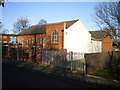
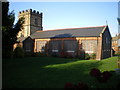
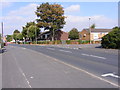
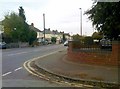
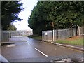
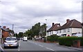
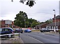
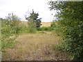
Photos of DY4 9JG
Area Information
DY4 9JG is a compact residential cluster in England, covering just 1.1 hectares and home to 1,738 residents. Its high population density of 154,966 people per square kilometre reflects a tightly knit community. The area is defined by its small scale, with housing predominantly in single-family homes. Residents here are largely adults aged 30–64, with a median age of 47. Daily life is shaped by proximity to nearby amenities, including retail outlets and transport links. The area’s limited size means it is not a sprawling suburb but a focused residential hub. While it lacks large-scale infrastructure, its proximity to rail stations and metro stops offers connectivity to surrounding towns. The demographic profile suggests a mature, established community, though the 32% home ownership rate indicates a significant proportion of residents may be renters. For buyers, this small area presents a mix of practicality and constraints, with limited space but strong local access to essentials.
- Area Type
- Postcode
- Area Size
- 1.1 hectares
- Population
- 1738
- Population Density
- 5459 people/km²
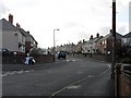
The property market in DY4 9JG is characterised by a 32% home ownership rate, indicating that most residents are renters rather than homeowners. The accommodation type is primarily houses, not flats or apartments, which is unusual for a densely populated area. This suggests a mix of older, single-family homes and possibly some newer developments. The small area size and high population density mean that the housing stock is limited, which could drive competition among buyers. For those considering the area, the predominance of houses may appeal to families seeking space, though the lack of high home ownership suggests affordability challenges. The immediate surroundings likely offer similar housing options, but buyers should consider the area’s compact nature and limited expansion potential.
House Prices in DY4 9JG
Showing 26 properties
| Address | Type | Beds | Baths | Last Sale Price | Last Sale Date | |
|---|---|---|---|---|---|---|
| 6 Parkes Lane, Tipton, DY4 9JG | house | 2 | 1 | £190,000 | Nov 2025 | |
| 2 Parkes Lane, Tipton, DY4 9JG | house | - | - | £232,000 | Aug 2022 | |
| 5 Parkes Lane, Tipton, DY4 9JG | house | - | - | £120,000 | Jun 2021 | |
| 1 Parkes Lane, Tipton, DY4 9JG | Semi-detached | 3 | 1 | £135,000 | Aug 2020 | |
| 20 Parkes Lane, Tipton, DY4 9JG | Semi-detached | 3 | 1 | £135,000 | Feb 2019 | |
| 23 Parkes Lane, Tipton, DY4 9JG | house | - | - | £90,000 | Mar 2014 | |
| 24 Parkes Lane, Tipton, DY4 9JG | house | 3 | - | £83,000 | Jan 2014 | |
| 7 Parkes Lane, Tipton, DY4 9JG | Semi-detached | - | - | £119,000 | May 2008 | |
| 12 Parkes Lane, Tipton, DY4 9JG | Semi-detached | - | - | £33,500 | Jan 2002 | |
| 10 Parkes Lane, Tipton, DY4 9JG | Semi-detached | 3 | 1 | £45,000 | Apr 2001 |
Energy Efficiency in DY4 9JG
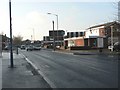
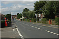
Daily life in DY4 9JG is shaped by nearby retail and transport hubs. Within practical reach are five retail outlets, including Farmfoods Tipton, Heron Princes, and Asda Tipton, offering shopping and grocery needs. The area’s rail and metro stations—Coseley, Tipton, Dudley Port, Bradley Lane, Loxdale, and Bilston Central—provide direct links to employment centres and leisure destinations. While the data does not mention parks or leisure facilities, the proximity to transport suggests access to regional amenities. The compact nature of the area means residents may rely on nearby towns for larger-scale recreation. The mix of retail and transport options supports a convenient lifestyle, though the lack of local green spaces or cultural venues may require travel for a full range of activities.
Amenities
Schools
Near DY4 9JG are two educational institutions: Batmans Hill Nursery School, which provides early years education, and Batmans Hill Unit, described as an “other” type of school. The absence of primary or secondary schools in the data means families may need to look further afield for comprehensive education. The presence of a nursery school is a benefit for young children, though parents with older children may need to travel to nearby towns for secondary schooling. The mix of nursery and unspecified educational facilities suggests a focus on early education but leaves gaps for older age groups. This could be a consideration for families prioritising school proximity, though the area’s compact size may limit options.
| Rank | School | Type | Entry gender | Ages |
|---|
Explore more schools in this area
Go to Schools tabDemographics
The population of DY4 9JG is predominantly adults aged 30–64, with a median age of 47. This suggests a community of working-age individuals and families, though the 32% home ownership rate indicates a high proportion of renters. The area’s accommodation is largely houses, not flats or apartments, reflecting a traditional housing stock. The predominant ethnic group is White, with no data provided on other demographics. The population density of 154,966 people per square kilometre is exceptionally high for a residential area, which may influence living conditions and community dynamics. While the data does not specify deprivation levels, such density could imply shared resources and potential strain on local services. The age profile suggests a stable, mature population, but the low home ownership rate may indicate economic or housing market pressures.
Household Size
Accommodation Type
Tenure
Ethnic Group
Religion
Household Composition
Age
Household Deprivation
NS-SEC
Explore more demographic insights in this area
Go to Demographics tabPlanning
Planning Constraints
- Flood RiskPremium
- Ramsar Wetland SitesPremium
- Area of Outstanding Natural BeautyPremium
- Protected Nature ReservePremium
- Protected WoodlandPremium