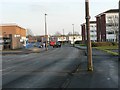
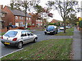
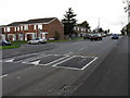
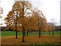
Area Overview for DY4 9JB
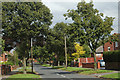
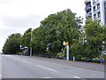
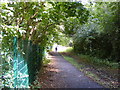
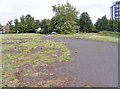
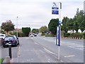
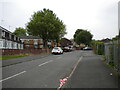
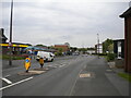
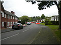
Photos of DY4 9JB
Area Information
Living in DY4 9JB means being part of a tightly packed residential cluster that balances compactness with practicality. The area covers just 2.6 hectares, yet it accommodates 1,544 residents, translating to a population density of 58,544 people per square kilometre. This high density reflects a mature community, with a median age of 47 and the majority of residents aged between 30 and 64. Daily life here is shaped by proximity to essential services, including five retail outlets like Asda Tipton and Farmfoods Tipton, alongside five metro stops and three rail stations within reach. The area’s small footprint means residents are likely to know their neighbours, though the limited space may feel constricted for larger families. Despite its size, DY4 9JB offers access to a range of transport options, from local train lines to motorway links, ensuring connectivity to nearby towns. For those prioritising convenience over space, this postcode’s compact layout and amenities make it a pragmatic choice for those seeking a settled, community-focused lifestyle.
- Area Type
- Postcode
- Area Size
- 2.6 hectares
- Population
- 1544
- Population Density
- 4182 people/km²
The property market in DY4 9JB is characterised by a low home ownership rate of 33%, suggesting that the area is more rental-focused than owner-occupied. The predominant accommodation type is houses, which is unusual for a small postcode with such high population density. This mix implies that properties are likely to be smaller, possibly semi-detached or terraced homes, accommodating the needs of a mature demographic. Buyers considering this area should be aware of its limited size, which may restrict housing stock and competition for available properties. The small footprint of DY4 9JB means that any new developments would face spatial constraints, potentially limiting future growth. For those seeking a home, the area’s proximity to transport links and amenities could offset its compact nature, though the rental market may offer more immediate availability than owner-occupied options.
House Prices in DY4 9JB
Showing 26 properties
| Address | Type | Beds | Baths | Last Sale Price | Last Sale Date | |
|---|---|---|---|---|---|---|
| 194 High Street, Princes End, Tipton, DY4 9JB | Detached | 5 | 4 | £460,000 | Dec 2023 | |
| 204 High Street, Princes End, Tipton, DY4 9JB | Bungalow | - | - | £20,000 | Feb 2023 | |
| 226 High Street, Princes End, Tipton, DY4 9JB | house | - | - | £175,000 | Oct 2021 | |
| 212 High Street, Princes End, Tipton, DY4 9JB | Semi-detached | 3 | 1 | £109,995 | May 2019 | |
| 208 High Street, Princes End, Tipton, DY4 9JB | Semi-detached | 3 | 1 | £230,000 | May 2019 | |
| 228 High Street, Princes End, Tipton, DY4 9JB | Semi-detached | 3 | 1 | £172,500 | Aug 2018 | |
| 218 High Street, Princes End, Tipton, DY4 9JB | Semi-detached | 2 | 1 | £88,500 | Jun 2016 | |
| 198 High Street, Princes End, Tipton, DY4 9JB | Bungalow | 2 | 1 | £115,000 | Dec 2014 | |
| 216 High Street, Princes End, Tipton, DY4 9JB | Semi-detached | 2 | 1 | £87,000 | Jul 2014 | |
| 200 High Street, Princes End, Tipton, DY4 9JB | Bungalow | 2 | - | £100,000 | Dec 2012 |
Energy Efficiency in DY4 9JB
Daily life in DY4 9JB is supported by a range of amenities within easy reach. The area’s retail offerings include Asda Tipton, Heron Princes, and Farmfoods Tipton, providing access to groceries, clothing, and household essentials. Nearby metro stops such as Bradley Lane and Wednesbury Parkway offer convenient links to local shopping and transport hubs. Rail stations like Tipton Railway Station and Dudley Port Railway Station connect residents to broader regional networks, facilitating travel to work or leisure activities. While the area lacks large parks or recreational spaces, its proximity to transport and retail ensures that residents can access outdoor activities, dining, and entertainment in nearby towns. The compact layout means that amenities are closely clustered, reducing the need for long commutes. This convenience, combined with reliable connectivity, contributes to a lifestyle that balances practicality with accessibility.
Amenities
Schools
The nearest school to DY4 9JB is Glebefields Primary School, which serves the local community with primary education. While the data lists the school twice, it is likely a single institution catering to the area’s children. The absence of secondary schools or additional educational institutions nearby means families may need to travel to adjacent areas for higher education. The presence of a primary school is a key consideration for parents, though the lack of secondary options could be a drawback for those prioritising a full range of local schooling. The school’s type and performance are not specified, but its proximity to the postcode ensures accessibility for residents. For families, this means a reliance on the primary school for early education, with potential planning required for secondary schooling elsewhere.
| Rank | School | Type | Entry gender | Ages |
|---|
Explore more schools in this area
Go to Schools tabDemographics
The community in DY4 9JB is predominantly composed of adults aged 30 to 64, with a median age of 47. This suggests a population that is largely in their prime working years, potentially contributing to a stable local economy. Home ownership rates are relatively low at 33%, indicating that a significant proportion of residents rent their homes. The accommodation type is primarily houses, which is notable given the area’s high population density. The predominant ethnic group is White, though specific data on diversity or deprivation is not available. The age profile and home ownership figures suggest a community that may be more transient than owner-occupied areas, with a focus on rental properties. This dynamic could influence local amenities and services, as the needs of renters—such as short-term housing and flexible tenancies—may shape the area’s character.
Household Size
Accommodation Type
Tenure
Ethnic Group
Religion
Household Composition
Age
Household Deprivation
NS-SEC
Explore more demographic insights in this area
Go to Demographics tabPlanning
Planning Constraints
- Flood RiskPremium
- Ramsar Wetland SitesPremium
- Area of Outstanding Natural BeautyPremium
- Protected Nature ReservePremium
- Protected WoodlandPremium