Area Overview for DY4 8XZ
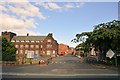
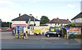
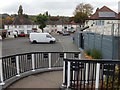
Photos of DY4 8XZ

Area Information
DY4 8XZ is a compact residential postcode area in England, covering just 1.8 hectares. Despite its small size, it hosts a population of 1,767 people, resulting in a high population density of 97,895 people per square kilometre. This suggests a tightly knit community with limited space for expansion. The area is characterised by a mix of housing types, though the data indicates a focus on individual homes rather than flats or apartments. Residents here are likely to experience a blend of urban and semi-rural living, with proximity to retail, transport, and educational facilities. The area’s small footprint means that amenities are concentrated within a short walk or drive, making it convenient for those prioritising accessibility. However, the high density may also mean a need for shared spaces or community planning. Living in DY4 8XZ offers a compact, connected environment, though buyers should consider the area’s limited size when evaluating long-term housing needs.
- Area Type
- Postcode
- Area Size
- 1.8 hectares
- Population
- 1767
- Population Density
- 3482 people/km²
The property market in DY4 8XZ is defined by a 42% home ownership rate, with the majority of accommodation being houses. This suggests a mix of owner-occupied and rental properties, though the exact balance between the two is unclear. The small area size of 1.8 hectares means the housing stock is limited, potentially making the market competitive for buyers. The focus on houses rather than flats or apartments may appeal to those seeking larger, more private living spaces. However, the compact nature of the area could mean limited scope for new developments, which may affect long-term property value growth. For buyers, the predominance of houses indicates a community-oriented environment, but the high population density and small footprint may also mean shared spaces or communal areas. Those considering DY4 8XZ should weigh the benefits of a tightly connected neighbourhood against potential constraints on property availability.
House Prices in DY4 8XZ
Showing 13 properties
| Address | Type | Beds | Baths | Last Sale Price | Last Sale Date | |
|---|---|---|---|---|---|---|
| 6 Barney Close, Tipton, DY4 8XZ | Detached | 4 | 2 | £342,500 | Apr 2024 | |
| 7 Barney Close, Tipton, DY4 8XZ | Detached | 3 | 2 | £270,000 | Jan 2022 | |
| 9 Barney Close, Tipton, DY4 8XZ | Detached | 4 | 1 | £231,000 | Dec 2017 | |
| 5 Barney Close, Tipton, DY4 8XZ | Detached | 4 | - | £184,500 | Jul 2014 | |
| 2 Barney Close, Tipton, DY4 8XZ | Detached | - | - | £165,000 | Aug 2004 | |
| 4 Barney Close, Tipton, DY4 8XZ | Detached | - | - | £183,000 | Aug 2004 | |
| 16 Barney Close, Tipton, DY4 8XZ | house | - | - | £123,000 | Sep 2000 | |
| 14 Barney Close, Tipton, DY4 8XZ | Detached | 4 | 2 | £93,500 | Aug 2000 | |
| 12 Barney Close, Tipton, DY4 8XZ | Detached | - | - | - | - | |
| 1 Barney Close, Tipton, DY4 8XZ | house | - | - | - | - |
Energy Efficiency in DY4 8XZ
Living in DY4 8XZ grants access to a range of amenities within practical reach. Retail options include Morrisons Daily, Tesco Dudley, and Co-op Tipton, providing everyday shopping convenience. The area’s rail and metro stations—such as Dudley Port and Black Lake—offer easy access to broader networks, facilitating commuting or leisure travel. While the data does not specify parks or leisure facilities, the proximity to multiple transport hubs and retail outlets suggests a lifestyle focused on accessibility and practicality. The presence of multiple shops and transport links indicates a community that values convenience and connectivity. For residents, daily life is likely shaped by the need to navigate a compact area with limited expansion, but the concentration of services ensures minimal effort in accessing essentials. This makes DY4 8XZ appealing to those prioritising ease of access over expansive green spaces.
Amenities
Schools
The nearest school to DY4 8XZ is Sacred Heart Primary School, which holds an Ofsted rating of ‘good’. This institution serves the local community, providing primary education for children in the area. The absence of secondary schools in the data means families with older children may need to seek options further afield. The presence of a primary school with a positive rating is a strong asset for parents prioritising education quality. However, the lack of secondary school data leaves gaps in understanding the full educational landscape. For families, this suggests that DY4 8XZ is well-suited for those with young children but may require additional planning for older students. The school’s rating indicates a reliable, if not exceptional, standard of teaching and facilities.
| Rank | School | Type | Entry gender | Ages |
|---|
Explore more schools in this area
Go to Schools tabDemographics
The population of DY4 8XZ is predominantly adults aged 30–64, with a median age of 47. This suggests a community of middle-aged residents, likely including families and professionals. Home ownership stands at 42%, indicating that nearly half of properties are owner-occupied, while the remaining 58% are likely rented. The accommodation type is primarily houses, which may reflect a preference for standalone homes over flats or apartments. The predominant ethnic group is White, though the data does not provide further breakdowns of diversity. The high population density, combined with the age profile, implies a mature, stable community with established social networks. However, the relatively low home ownership rate may point to a rental market that supports transient populations. For buyers, this demographic profile suggests a neighbourhood with a focus on family-friendly living, though the limited data on deprivation means quality of life factors remain unquantified.
Household Size
Accommodation Type
Tenure
Ethnic Group
Religion
Household Composition
Age
Household Deprivation
NS-SEC
Explore more demographic insights in this area
Go to Demographics tabPlanning
Planning Constraints
- Flood RiskPremium
- Ramsar Wetland SitesPremium
- Area of Outstanding Natural BeautyPremium
- Protected Nature ReservePremium
- Protected WoodlandPremium