Area Overview for DY4 8UF
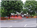
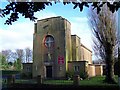
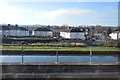
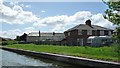
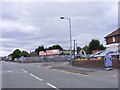
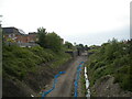
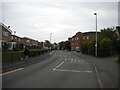
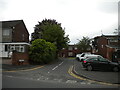
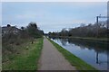
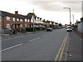
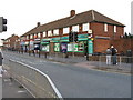
Photos of DY4 8UF

Area Information
DY4 8UF is a small, tightly packed residential postcode in England, covering just 5,414 square metres and home to 1,761 people. Its high population density of 325,276 people per square kilometre suggests a compact, closely knit community. The area is characterised by its modest scale, with housing stock primarily composed of houses rather than flats or apartments. This makes it a place where neighbours are likely to know one another, though the population’s median age of 47 and the prevalence of adults aged 30–64 indicate a mature, stable demographic. Daily life here is likely shaped by proximity to local amenities, with nearby shops, transport links, and schools playing a central role. While the area lacks natural or protected landscapes, its practical layout and accessibility to surrounding towns make it a pragmatic choice for those prioritising convenience over rural scenery. The high broadband score of 100 ensures seamless digital connectivity, supporting remote work or online learning, while mobile coverage of 85 is sufficient for everyday use. For buyers seeking a small, established residential cluster with functional infrastructure, DY4 8UF offers a straightforward, no-frills living environment.
- Area Type
- Postcode
- Area Size
- 5414 m²
- Population
- 1761
- Population Density
- 7904 people/km²
DY4 8UF is a small postcode with a housing stock entirely composed of houses, reflecting a focus on traditional, family-sized properties rather than apartments or flats. With a home ownership rate of 37%, the area is not heavily dominated by owner-occupied homes, suggesting a significant proportion of the housing is rented. This could indicate a mix of long-term residents and transient occupants, possibly including young professionals or those in temporary employment. The compact size of the postcode means the property market is limited to a small number of homes, likely concentrated in a single residential cluster. Buyers should consider that the area’s immediate surroundings may offer additional options, though the data does not specify. For those prioritising a house in a quiet, established neighbourhood, DY4 8UF provides a straightforward choice, though the low ownership rate may affect long-term investment potential.
House Prices in DY4 8UF
Showing 35 properties
| Address | Type | Beds | Baths | Last Sale Price | Last Sale Date | |
|---|---|---|---|---|---|---|
| 14 Howard Street, Tipton, DY4 8UF | Maisonette | 3 | 1 | £120,000 | Feb 2022 | |
| 34 Howard Street, Tipton, DY4 8UF | Bungalow | 2 | - | £95,000 | Aug 2017 | |
| 33 Howard Street, Tipton, DY4 8UF | Semi-detached | 2 | 1 | £87,500 | Apr 2015 | |
| 32 Howard Street, Tipton, DY4 8UF | Semi-detached | 2 | 1 | £117,000 | Apr 2015 | |
| 36 Howard Street, Tipton, DY4 8UF | Bungalow | 2 | - | £106,000 | Nov 2013 | |
| 13 Howard Street, Tipton, DY4 8UF | Flat | - | - | - | - | |
| 12 Howard Street, Tipton, DY4 8UF | Flat | - | - | - | - | |
| 6 Howard Street, Tipton, DY4 8UF | Flat | - | - | - | - | |
| 7 Howard Street, Tipton, DY4 8UF | Flat | - | - | - | - | |
| 22 Howard Street, Tipton, DY4 8UF | Flat | - | - | - | - |
Energy Efficiency in DY4 8UF
Living in DY4 8UF offers access to a range of local amenities that cater to daily needs. The nearby retail options include Morrisons Daily, Co-op Upper, and Lidl Tipton, providing essential shopping for groceries and household items. For leisure and transport, the area is close to metro hubs such as Black Lake, Dudley Street Guns Village, and Wednesbury Parkway, which may offer recreational spaces or transport links. While the data does not specify parks or green spaces, the proximity to rail stations and retail areas suggests a lifestyle focused on practicality and connectivity. The compact nature of the postcode means residents can reach these amenities quickly, supporting a routine that balances local convenience with access to surrounding towns. The absence of detailed information on parks or cultural venues means the area’s recreational offerings remain undefined, though the existing infrastructure prioritises accessibility over luxury.
Amenities
Schools
Residents of DY4 8UF have access to two schools within practical reach. St Martin’s CofE Primary School is a primary school with an Ofsted rating of ‘good’, indicating it meets standard educational benchmarks. Dudley Port School, a special school, has an Ofsted rating of ‘satisfactory’, suggesting it provides tailored support for students with specific needs. The combination of a primary school and a special school offers families a range of educational options, though the absence of secondary schools may require commuting to nearby towns. For parents prioritising proximity to schools, the presence of both a mainstream primary and a specialist institution is a practical advantage, though the area’s small size limits the availability of additional educational facilities.
| Rank | School | Type | Entry gender | Ages |
|---|
Explore more schools in this area
Go to Schools tabDemographics
The population of DY4 8UF is predominantly composed of adults aged 30–64, with a median age of 47. This suggests a community of middle-aged residents, likely including families and professionals settled in the area. Home ownership is relatively low at 37%, indicating that a significant portion of the housing stock is rented, possibly by younger individuals or those seeking flexibility. The accommodation type is exclusively houses, which contrasts with areas where flats or apartments dominate. The predominant ethnic group is White, though no specific data on diversity or deprivation is provided. The age profile and home ownership figures imply a stable, long-term resident base, though the low ownership rate may reflect a mix of rental properties or temporary housing. The absence of detailed diversity statistics means the community’s cultural composition remains unspecified. For buyers, this demographic profile suggests a focus on practical, family-oriented housing rather than luxury or niche markets.
Household Size
Accommodation Type
Tenure
Ethnic Group
Religion
Household Composition
Age
Household Deprivation
NS-SEC
Explore more demographic insights in this area
Go to Demographics tabPlanning
Planning Constraints
- Flood RiskPremium
- Ramsar Wetland SitesPremium
- Area of Outstanding Natural BeautyPremium
- Protected Nature ReservePremium
- Protected WoodlandPremium